You are here: Home > Network List > CN - Canadian National Seismograph Network Stations List
> Station INK INUVIK, NT > Earthquake Result Viewer
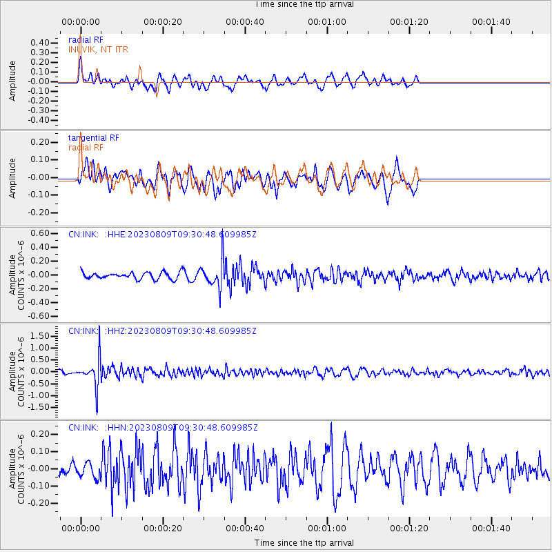
INK INUVIK, NT - Earthquake Result Viewer
*The percent match for this event was below the threshold and hence no stack was calculated.
| Earthquake location: |
Mariana Islands |
| Earthquake latitude/longitude: |
13.4/144.3 |
| Earthquake time(UTC): |
2023/08/09 (221) 09:20:31 GMT |
| Earthquake Depth: |
494 km |
| Earthquake Magnitude: |
5.7 Mi |
| Earthquake Catalog/Contributor: |
NEIC PDE/pt |
|
| Network: |
CN Canadian National Seismograph Network |
| Station: |
INK INUVIK, NT |
| Lat/Lon: |
68.31 N/133.53 W |
| Elevation: |
44 m |
|
| Distance: |
74.7 deg |
| Az: |
22.448 deg |
| Baz: |
267.836 deg |
| Ray Param: |
$rayparam |
*The percent match for this event was below the threshold and hence was not used in the summary stack. |
|
| Radial Match: |
68.47054 % |
| Radial Bump: |
400 |
| Transverse Match: |
59.35504 % |
| Transverse Bump: |
400 |
| SOD ConfigId: |
31937991 |
| Insert Time: |
2023-08-23 09:34:24.205 +0000 |
| GWidth: |
2.5 |
| Max Bumps: |
400 |
| Tol: |
0.001 |
|
Signal To Noise
| Channel | StoN | STA | LTA |
| CN:INK: :HHZ:20230809T09:30:48.609985Z | 5.1200094 | 6.170809E-7 | 1.205234E-7 |
| CN:INK: :HHN:20230809T09:30:48.609985Z | 0.92795116 | 4.3034298E-8 | 4.6375607E-8 |
| CN:INK: :HHE:20230809T09:30:48.609985Z | 4.1506176 | 1.9984914E-7 | 4.8149253E-8 |
| Arrivals |
| Ps | |
| PpPs | |
| PsPs/PpSs | |


