You are here: Home > Network List > US - United States National Seismic Network Stations List
> Station WUAZ Wupatki, Arizona, USA > Earthquake Result Viewer
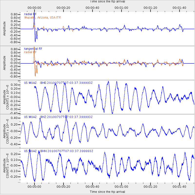
WUAZ Wupatki, Arizona, USA - Earthquake Result Viewer
*The percent match for this event was below the threshold and hence no stack was calculated.
| Earthquake location: |
Solomon Islands |
| Earthquake latitude/longitude: |
-6.2/154.4 |
| Earthquake time(UTC): |
2010/07/07 (188) 06:50:40 GMT |
| Earthquake Depth: |
35 km |
| Earthquake Magnitude: |
5.6 MS, 5.3 MB, 5.9 MW, 5.7 MW |
| Earthquake Catalog/Contributor: |
WHDF/NEIC |
|
| Network: |
US United States National Seismic Network |
| Station: |
WUAZ Wupatki, Arizona, USA |
| Lat/Lon: |
35.52 N/111.37 W |
| Elevation: |
1592 m |
|
| Distance: |
97.0 deg |
| Az: |
55.048 deg |
| Baz: |
267.405 deg |
| Ray Param: |
$rayparam |
*The percent match for this event was below the threshold and hence was not used in the summary stack. |
|
| Radial Match: |
72.54133 % |
| Radial Bump: |
400 |
| Transverse Match: |
54.43042 % |
| Transverse Bump: |
361 |
| SOD ConfigId: |
319893 |
| Insert Time: |
2011-01-05 00:54:58.782 +0000 |
| GWidth: |
2.5 |
| Max Bumps: |
400 |
| Tol: |
0.001 |
|
Signal To Noise
| Channel | StoN | STA | LTA |
| US:WUAZ: :BHZ:20100707T07:03:37.399993Z | 1.4121339 | 1.977608E-7 | 1.4004394E-7 |
| US:WUAZ: :BHN:20100707T07:03:37.399993Z | 2.706928 | 1.8914498E-7 | 6.98744E-8 |
| US:WUAZ: :BHE:20100707T07:03:37.399993Z | 0.37975568 | 8.667798E-8 | 2.2824669E-7 |
| Arrivals |
| Ps | |
| PpPs | |
| PsPs/PpSs | |


