You are here: Home > Network List > CI - Caltech Regional Seismic Network Stations List
> Station SWS Sam W. Stewart, Westmorland, CA, USA > Earthquake Result Viewer
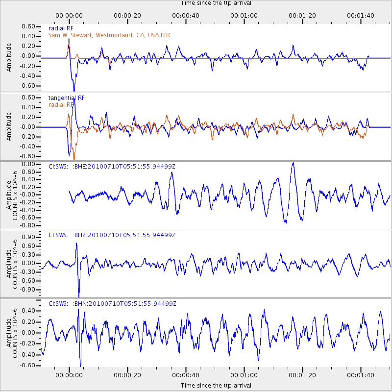
SWS Sam W. Stewart, Westmorland, CA, USA - Earthquake Result Viewer
*The percent match for this event was below the threshold and hence no stack was calculated.
| Earthquake location: |
Mariana Islands |
| Earthquake latitude/longitude: |
14.0/145.0 |
| Earthquake time(UTC): |
2010/07/10 (191) 05:39:43 GMT |
| Earthquake Depth: |
136 km |
| Earthquake Magnitude: |
5.6 MB, 5.6 MW, 5.5 MW |
| Earthquake Catalog/Contributor: |
WHDF/NEIC |
|
| Network: |
CI Caltech Regional Seismic Network |
| Station: |
SWS Sam W. Stewart, Westmorland, CA, USA |
| Lat/Lon: |
32.94 N/115.80 W |
| Elevation: |
140 m |
|
| Distance: |
90.0 deg |
| Az: |
56.112 deg |
| Baz: |
286.62 deg |
| Ray Param: |
$rayparam |
*The percent match for this event was below the threshold and hence was not used in the summary stack. |
|
| Radial Match: |
59.03387 % |
| Radial Bump: |
400 |
| Transverse Match: |
73.39437 % |
| Transverse Bump: |
400 |
| SOD ConfigId: |
319893 |
| Insert Time: |
2011-01-05 01:02:08.582 +0000 |
| GWidth: |
2.5 |
| Max Bumps: |
400 |
| Tol: |
0.001 |
|
Signal To Noise
| Channel | StoN | STA | LTA |
| CI:SWS: :BHZ:20100710T05:51:55.94499Z | 4.2362375 | 3.7021513E-7 | 8.7392436E-8 |
| CI:SWS: :BHN:20100710T05:51:55.94499Z | 1.212355 | 2.0402216E-7 | 1.6828582E-7 |
| CI:SWS: :BHE:20100710T05:51:55.94499Z | 2.9331317 | 2.6797622E-7 | 9.1361805E-8 |
| Arrivals |
| Ps | |
| PpPs | |
| PsPs/PpSs | |


