You are here: Home > Network List > CI - Caltech Regional Seismic Network Stations List
> Station SMM Simmler, CA, USA > Earthquake Result Viewer
SMM Simmler, CA, USA - Earthquake Result Viewer
*The percent match for this event was below the threshold and hence no stack was calculated.
| Earthquake location: |
Mariana Islands |
| Earthquake latitude/longitude: |
14.0/145.0 |
| Earthquake time(UTC): |
2010/07/10 (191) 05:39:43 GMT |
| Earthquake Depth: |
136 km |
| Earthquake Magnitude: |
5.6 MB, 5.6 MW, 5.5 MW |
| Earthquake Catalog/Contributor: |
WHDF/NEIC |
|
| Network: |
CI Caltech Regional Seismic Network |
| Station: |
SMM Simmler, CA, USA |
| Lat/Lon: |
35.31 N/120.00 W |
| Elevation: |
599 m |
|
| Distance: |
86.0 deg |
| Az: |
54.757 deg |
| Baz: |
284.226 deg |
| Ray Param: |
$rayparam |
*The percent match for this event was below the threshold and hence was not used in the summary stack. |
|
| Radial Match: |
50.404896 % |
| Radial Bump: |
400 |
| Transverse Match: |
46.763634 % |
| Transverse Bump: |
400 |
| SOD ConfigId: |
319893 |
| Insert Time: |
2011-01-05 01:02:49.609 +0000 |
| GWidth: |
2.5 |
| Max Bumps: |
400 |
| Tol: |
0.001 |
|
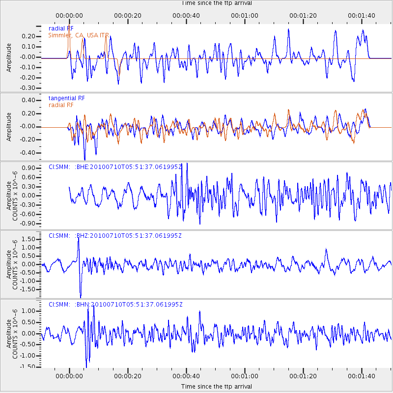
Signal To Noise
| Channel | StoN | STA | LTA |
| CI:SMM: :BHZ:20100710T05:51:37.061995Z | 5.153422 | 7.1731716E-7 | 1.391924E-7 |
| CI:SMM: :BHN:20100710T05:51:37.061995Z | 1.221149 | 2.5727073E-7 | 2.1067923E-7 |
| CI:SMM: :BHE:20100710T05:51:37.061995Z | 1.2938825 | 2.9033734E-7 | 2.2439235E-7 |
| Arrivals |
| Ps | |
| PpPs | |
| PsPs/PpSs | |


