You are here: Home > Network List > WI - West Indies IPGP Network Stations List
> Station BIM Morne Bigot, Anses d'Arlets, Martinique > Earthquake Result Viewer
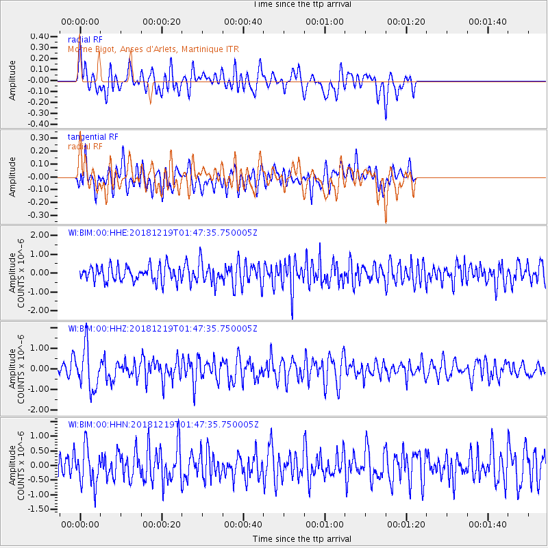
BIM Morne Bigot, Anses d'Arlets, Martinique - Earthquake Result Viewer
*The percent match for this event was below the threshold and hence no stack was calculated.
| Earthquake location: |
Southeast Of Easter Island |
| Earthquake latitude/longitude: |
-36.1/-101.0 |
| Earthquake time(UTC): |
2018/12/19 (353) 01:37:40 GMT |
| Earthquake Depth: |
10 km |
| Earthquake Magnitude: |
6.2 Mww |
| Earthquake Catalog/Contributor: |
NEIC PDE/us |
|
| Network: |
WI West Indies IPGP Network |
| Station: |
BIM Morne Bigot, Anses d'Arlets, Martinique |
| Lat/Lon: |
14.52 N/61.07 W |
| Elevation: |
391 m |
|
| Distance: |
62.9 deg |
| Az: |
44.296 deg |
| Baz: |
215.722 deg |
| Ray Param: |
$rayparam |
*The percent match for this event was below the threshold and hence was not used in the summary stack. |
|
| Radial Match: |
49.89993 % |
| Radial Bump: |
400 |
| Transverse Match: |
49.25709 % |
| Transverse Bump: |
400 |
| SOD ConfigId: |
3201911 |
| Insert Time: |
2019-01-02 01:59:18.210 +0000 |
| GWidth: |
2.5 |
| Max Bumps: |
400 |
| Tol: |
0.001 |
|
Signal To Noise
| Channel | StoN | STA | LTA |
| WI:BIM:00:HHZ:20181219T01:47:35.750005Z | 2.9926157 | 1.0282022E-6 | 3.4357979E-7 |
| WI:BIM:00:HHN:20181219T01:47:35.750005Z | 1.6710566 | 6.469088E-7 | 3.8712562E-7 |
| WI:BIM:00:HHE:20181219T01:47:35.750005Z | 1.4130048 | 5.718493E-7 | 4.0470442E-7 |
| Arrivals |
| Ps | |
| PpPs | |
| PsPs/PpSs | |


