You are here: Home > Network List > UW - Pacific Northwest Regional Seismic Network Stations List
> Station UMAT Pilot Rock, OR, USA > Earthquake Result Viewer
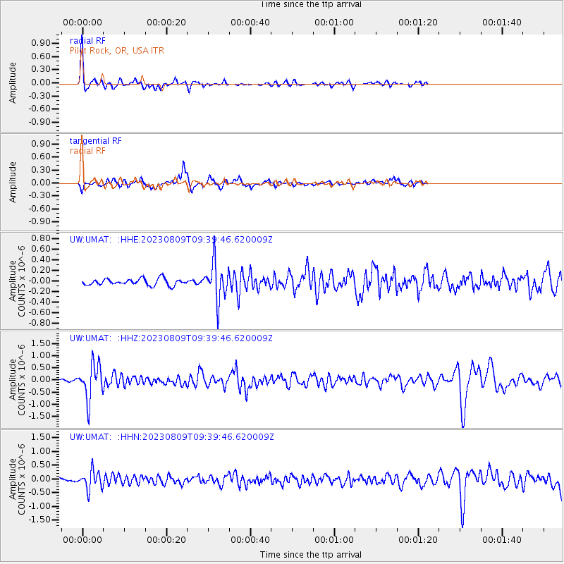
UMAT Pilot Rock, OR, USA - Earthquake Result Viewer
*The percent match for this event was below the threshold and hence no stack was calculated.
| Earthquake location: |
Chiapas, Mexico |
| Earthquake latitude/longitude: |
16.2/-93.6 |
| Earthquake time(UTC): |
2023/08/09 (221) 09:33:26 GMT |
| Earthquake Depth: |
111 km |
| Earthquake Magnitude: |
5.8 mww |
| Earthquake Catalog/Contributor: |
NEIC PDE/us |
|
| Network: |
UW Pacific Northwest Regional Seismic Network |
| Station: |
UMAT Pilot Rock, OR, USA |
| Lat/Lon: |
45.29 N/118.96 W |
| Elevation: |
1318 m |
|
| Distance: |
36.0 deg |
| Az: |
329.02 deg |
| Baz: |
135.518 deg |
| Ray Param: |
$rayparam |
*The percent match for this event was below the threshold and hence was not used in the summary stack. |
|
| Radial Match: |
78.69205 % |
| Radial Bump: |
321 |
| Transverse Match: |
69.1135 % |
| Transverse Bump: |
307 |
| SOD ConfigId: |
31937991 |
| Insert Time: |
2023-08-23 10:13:29.831 +0000 |
| GWidth: |
2.5 |
| Max Bumps: |
400 |
| Tol: |
0.001 |
|
Signal To Noise
| Channel | StoN | STA | LTA |
| UW:UMAT: :HHZ:20230809T09:39:46.620009Z | 11.06944 | 7.183614E-7 | 6.489591E-8 |
| UW:UMAT: :HHN:20230809T09:39:46.620009Z | 7.4537086 | 3.3393016E-7 | 4.480054E-8 |
| UW:UMAT: :HHE:20230809T09:39:46.620009Z | 6.0824323 | 3.6941395E-7 | 6.073458E-8 |
| Arrivals |
| Ps | |
| PpPs | |
| PsPs/PpSs | |


