You are here: Home > Network List > IU - Global Seismograph Network (GSN - IRIS/USGS) Stations List
> Station CTAO Charters Towers, Australia > Earthquake Result Viewer
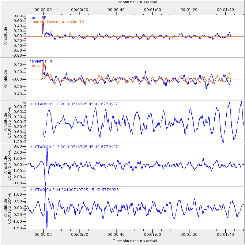
CTAO Charters Towers, Australia - Earthquake Result Viewer
*The percent match for this event was below the threshold and hence no stack was calculated.
| Earthquake location: |
Mariana Islands |
| Earthquake latitude/longitude: |
14.0/145.0 |
| Earthquake time(UTC): |
2010/07/10 (191) 05:39:43 GMT |
| Earthquake Depth: |
136 km |
| Earthquake Magnitude: |
5.6 MB, 5.6 MW, 5.5 MW |
| Earthquake Catalog/Contributor: |
WHDF/NEIC |
|
| Network: |
IU Global Seismograph Network (GSN - IRIS/USGS) |
| Station: |
CTAO Charters Towers, Australia |
| Lat/Lon: |
20.09 S/146.25 E |
| Elevation: |
357 m |
|
| Distance: |
33.9 deg |
| Az: |
177.93 deg |
| Baz: |
357.862 deg |
| Ray Param: |
$rayparam |
*The percent match for this event was below the threshold and hence was not used in the summary stack. |
|
| Radial Match: |
60.18685 % |
| Radial Bump: |
400 |
| Transverse Match: |
65.65475 % |
| Transverse Bump: |
366 |
| SOD ConfigId: |
319893 |
| Insert Time: |
2011-01-05 01:06:22.594 +0000 |
| GWidth: |
2.5 |
| Max Bumps: |
400 |
| Tol: |
0.001 |
|
Signal To Noise
| Channel | StoN | STA | LTA |
| IU:CTAO:00:BHZ:20100710T05:45:42.677992Z | 3.0043843 | 1.3457053E-6 | 4.4791383E-7 |
| IU:CTAO:00:BHN:20100710T05:45:42.677992Z | 2.9438348 | 6.83082E-7 | 2.3203816E-7 |
| IU:CTAO:00:BHE:20100710T05:45:42.677992Z | 1.5675539 | 5.1705734E-7 | 3.298498E-7 |
| Arrivals |
| Ps | |
| PpPs | |
| PsPs/PpSs | |


