You are here: Home > Network List > TA - USArray Transportable Network (new EarthScope stations) Stations List
> Station H20A Greybull, WY, USA > Earthquake Result Viewer
H20A Greybull, WY, USA - Earthquake Result Viewer
*The percent match for this event was below the threshold and hence no stack was calculated.
| Earthquake location: |
Mariana Islands |
| Earthquake latitude/longitude: |
14.0/145.0 |
| Earthquake time(UTC): |
2010/07/10 (191) 05:39:43 GMT |
| Earthquake Depth: |
136 km |
| Earthquake Magnitude: |
5.6 MB, 5.6 MW, 5.5 MW |
| Earthquake Catalog/Contributor: |
WHDF/NEIC |
|
| Network: |
TA USArray Transportable Network (new EarthScope stations) |
| Station: |
H20A Greybull, WY, USA |
| Lat/Lon: |
44.49 N/108.00 W |
| Elevation: |
1236 m |
|
| Distance: |
92.0 deg |
| Az: |
43.235 deg |
| Baz: |
291.732 deg |
| Ray Param: |
$rayparam |
*The percent match for this event was below the threshold and hence was not used in the summary stack. |
|
| Radial Match: |
65.15579 % |
| Radial Bump: |
400 |
| Transverse Match: |
42.38637 % |
| Transverse Bump: |
400 |
| SOD ConfigId: |
319893 |
| Insert Time: |
2011-01-05 01:10:36.421 +0000 |
| GWidth: |
2.5 |
| Max Bumps: |
400 |
| Tol: |
0.001 |
|
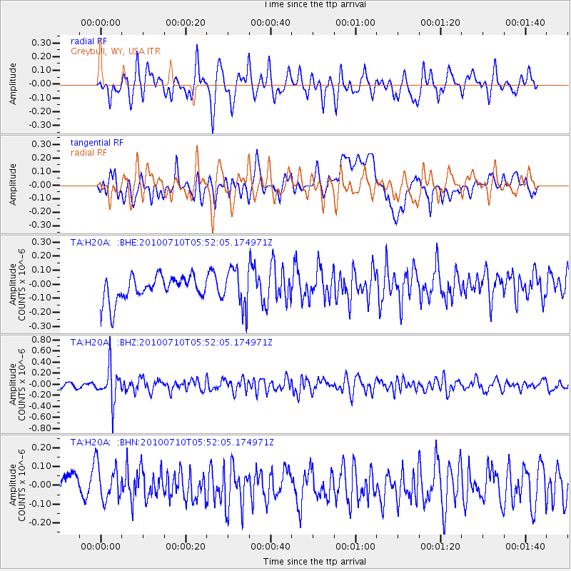
Signal To Noise
| Channel | StoN | STA | LTA |
| TA:H20A: :BHZ:20100710T05:52:05.174971Z | 4.846386 | 3.1722146E-7 | 6.545526E-8 |
| TA:H20A: :BHN:20100710T05:52:05.174971Z | 1.055701 | 1.0077209E-7 | 9.545515E-8 |
| TA:H20A: :BHE:20100710T05:52:05.174971Z | 1.5925753 | 1.3800846E-7 | 8.6657415E-8 |
| Arrivals |
| Ps | |
| PpPs | |
| PsPs/PpSs | |


