You are here: Home > Network List > TA - USArray Transportable Network (new EarthScope stations) Stations List
> Station D22A Cohagen, MT, USA > Earthquake Result Viewer
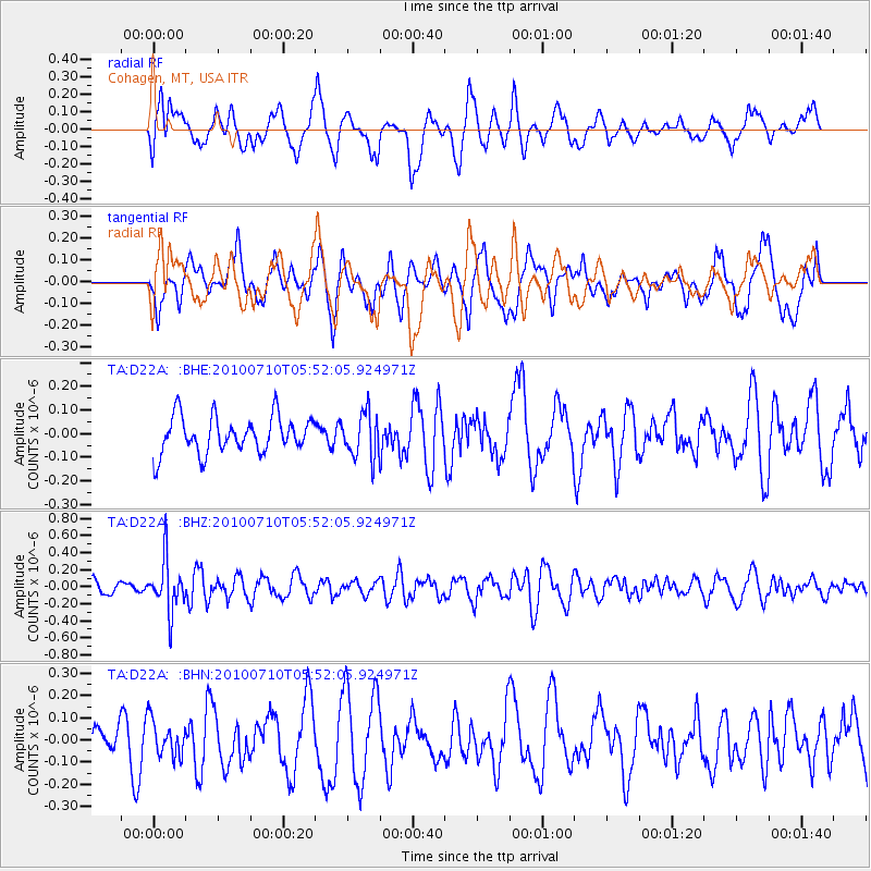
D22A Cohagen, MT, USA - Earthquake Result Viewer
*The percent match for this event was below the threshold and hence no stack was calculated.
| Earthquake location: |
Mariana Islands |
| Earthquake latitude/longitude: |
14.0/145.0 |
| Earthquake time(UTC): |
2010/07/10 (191) 05:39:43 GMT |
| Earthquake Depth: |
136 km |
| Earthquake Magnitude: |
5.6 MB, 5.6 MW, 5.5 MW |
| Earthquake Catalog/Contributor: |
WHDF/NEIC |
|
| Network: |
TA USArray Transportable Network (new EarthScope stations) |
| Station: |
D22A Cohagen, MT, USA |
| Lat/Lon: |
47.15 N/106.18 W |
| Elevation: |
791 m |
|
| Distance: |
92.2 deg |
| Az: |
40.286 deg |
| Baz: |
293.14 deg |
| Ray Param: |
$rayparam |
*The percent match for this event was below the threshold and hence was not used in the summary stack. |
|
| Radial Match: |
59.86909 % |
| Radial Bump: |
400 |
| Transverse Match: |
53.39045 % |
| Transverse Bump: |
400 |
| SOD ConfigId: |
319893 |
| Insert Time: |
2011-01-05 01:12:04.446 +0000 |
| GWidth: |
2.5 |
| Max Bumps: |
400 |
| Tol: |
0.001 |
|
Signal To Noise
| Channel | StoN | STA | LTA |
| TA:D22A: :BHZ:20100710T05:52:05.924971Z | 3.3711834 | 3.0327456E-7 | 8.9960864E-8 |
| TA:D22A: :BHN:20100710T05:52:05.924971Z | 0.55101186 | 8.0204124E-8 | 1.4555789E-7 |
| TA:D22A: :BHE:20100710T05:52:05.924971Z | 1.224238 | 9.391853E-8 | 7.671591E-8 |
| Arrivals |
| Ps | |
| PpPs | |
| PsPs/PpSs | |


