You are here: Home > Network List > GS - US Geological Survey Networks Stations List
> Station OK031 S. Brethren Rd., Cushing, OK, USA > Earthquake Result Viewer
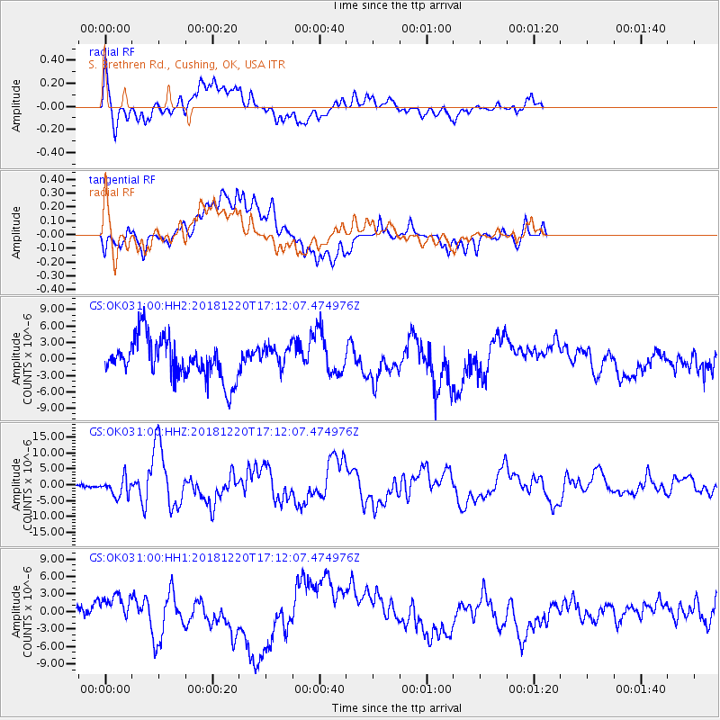
OK031 S. Brethren Rd., Cushing, OK, USA - Earthquake Result Viewer
*The percent match for this event was below the threshold and hence no stack was calculated.
| Earthquake location: |
Komandorskiye Ostrova Region |
| Earthquake latitude/longitude: |
54.8/164.8 |
| Earthquake time(UTC): |
2018/12/20 (354) 17:01:56 GMT |
| Earthquake Depth: |
33 km |
| Earthquake Magnitude: |
7.3 Mi |
| Earthquake Catalog/Contributor: |
NEIC PDE/pt |
|
| Network: |
GS US Geological Survey Networks |
| Station: |
OK031 S. Brethren Rd., Cushing, OK, USA |
| Lat/Lon: |
35.95 N/96.84 W |
| Elevation: |
290 m |
|
| Distance: |
65.9 deg |
| Az: |
61.605 deg |
| Baz: |
321.17 deg |
| Ray Param: |
$rayparam |
*The percent match for this event was below the threshold and hence was not used in the summary stack. |
|
| Radial Match: |
46.12416 % |
| Radial Bump: |
400 |
| Transverse Match: |
49.696144 % |
| Transverse Bump: |
400 |
| SOD ConfigId: |
3201911 |
| Insert Time: |
2019-01-03 17:13:42.186 +0000 |
| GWidth: |
2.5 |
| Max Bumps: |
400 |
| Tol: |
0.001 |
|
Signal To Noise
| Channel | StoN | STA | LTA |
| GS:OK031:00:HHZ:20181220T17:12:07.474976Z | 3.5815728 | 2.950749E-6 | 8.2386964E-7 |
| GS:OK031:00:HH1:20181220T17:12:07.474976Z | 0.72356683 | 3.1968036E-6 | 4.4181184E-6 |
| GS:OK031:00:HH2:20181220T17:12:07.474976Z | 0.55868304 | 2.021113E-6 | 3.6176382E-6 |
| Arrivals |
| Ps | |
| PpPs | |
| PsPs/PpSs | |


