You are here: Home > Network List > UW - Pacific Northwest Regional Seismic Network Stations List
> Station LCCR Mulino, OR, USA > Earthquake Result Viewer
LCCR Mulino, OR, USA - Earthquake Result Viewer
*The percent match for this event was below the threshold and hence no stack was calculated.
| Earthquake location: |
Mariana Islands |
| Earthquake latitude/longitude: |
14.0/145.0 |
| Earthquake time(UTC): |
2010/07/10 (191) 05:39:43 GMT |
| Earthquake Depth: |
136 km |
| Earthquake Magnitude: |
5.6 MB, 5.6 MW, 5.5 MW |
| Earthquake Catalog/Contributor: |
WHDF/NEIC |
|
| Network: |
UW Pacific Northwest Regional Seismic Network |
| Station: |
LCCR Mulino, OR, USA |
| Lat/Lon: |
45.21 N/122.48 W |
| Elevation: |
273 m |
|
| Distance: |
81.9 deg |
| Az: |
45.505 deg |
| Baz: |
281.648 deg |
| Ray Param: |
$rayparam |
*The percent match for this event was below the threshold and hence was not used in the summary stack. |
|
| Radial Match: |
57.640675 % |
| Radial Bump: |
400 |
| Transverse Match: |
62.144974 % |
| Transverse Bump: |
400 |
| SOD ConfigId: |
319893 |
| Insert Time: |
2011-01-05 01:22:58.376 +0000 |
| GWidth: |
2.5 |
| Max Bumps: |
400 |
| Tol: |
0.001 |
|
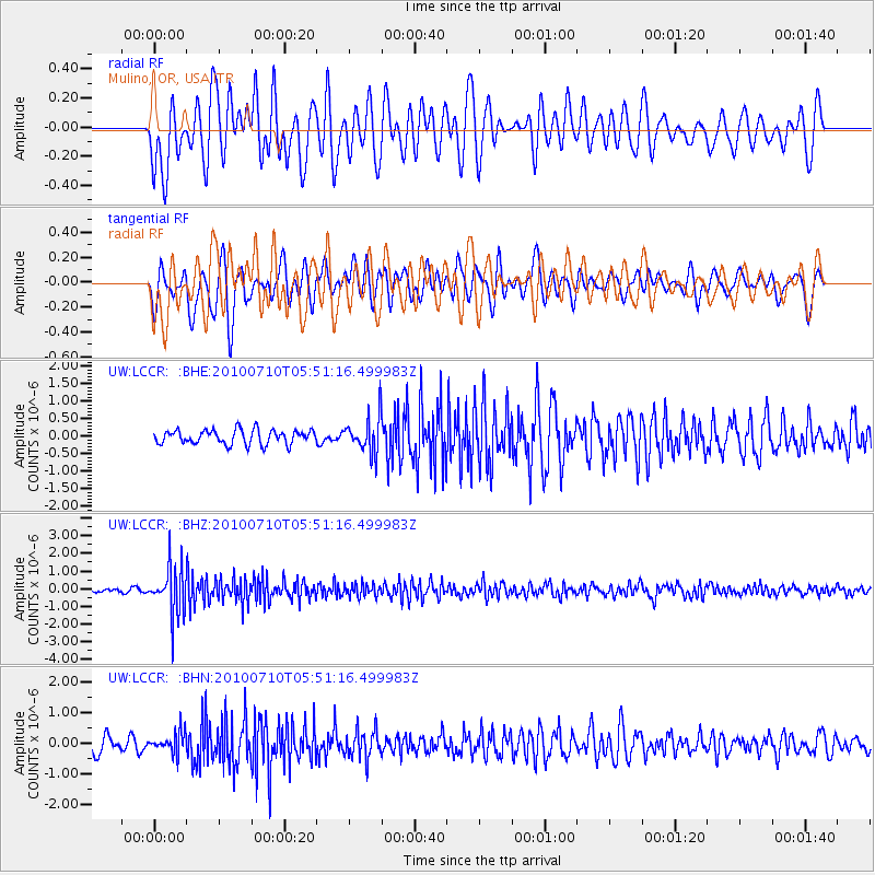
Signal To Noise
| Channel | StoN | STA | LTA |
| UW:LCCR: :BHZ:20100710T05:51:16.499983Z | 8.692805 | 1.3572344E-6 | 1.5613307E-7 |
| UW:LCCR: :BHN:20100710T05:51:16.499983Z | 1.3740791 | 3.355586E-7 | 2.4420618E-7 |
| UW:LCCR: :BHE:20100710T05:51:16.499983Z | 2.5749657 | 5.23954E-7 | 2.0347997E-7 |
| Arrivals |
| Ps | |
| PpPs | |
| PsPs/PpSs | |


