You are here: Home > Network List > UW - Pacific Northwest Regional Seismic Network Stations List
> Station LEBA Lebam, WA, USA > Earthquake Result Viewer
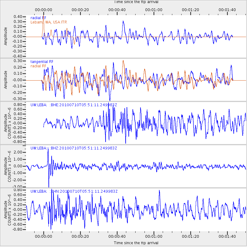
LEBA Lebam, WA, USA - Earthquake Result Viewer
*The percent match for this event was below the threshold and hence no stack was calculated.
| Earthquake location: |
Mariana Islands |
| Earthquake latitude/longitude: |
14.0/145.0 |
| Earthquake time(UTC): |
2010/07/10 (191) 05:39:43 GMT |
| Earthquake Depth: |
136 km |
| Earthquake Magnitude: |
5.6 MB, 5.6 MW, 5.5 MW |
| Earthquake Catalog/Contributor: |
WHDF/NEIC |
|
| Network: |
UW Pacific Northwest Regional Seismic Network |
| Station: |
LEBA Lebam, WA, USA |
| Lat/Lon: |
46.55 N/123.56 W |
| Elevation: |
73 m |
|
| Distance: |
80.9 deg |
| Az: |
44.324 deg |
| Baz: |
280.696 deg |
| Ray Param: |
$rayparam |
*The percent match for this event was below the threshold and hence was not used in the summary stack. |
|
| Radial Match: |
62.933224 % |
| Radial Bump: |
400 |
| Transverse Match: |
72.895775 % |
| Transverse Bump: |
400 |
| SOD ConfigId: |
319893 |
| Insert Time: |
2011-01-05 01:23:23.347 +0000 |
| GWidth: |
2.5 |
| Max Bumps: |
400 |
| Tol: |
0.001 |
|
Signal To Noise
| Channel | StoN | STA | LTA |
| UW:LEBA: :BHZ:20100710T05:51:11.249983Z | 5.395214 | 9.593577E-7 | 1.7781643E-7 |
| UW:LEBA: :BHN:20100710T05:51:11.249983Z | 1.7109998 | 3.3260105E-7 | 1.9438988E-7 |
| UW:LEBA: :BHE:20100710T05:51:11.249983Z | 1.9592388 | 2.5704117E-7 | 1.311944E-7 |
| Arrivals |
| Ps | |
| PpPs | |
| PsPs/PpSs | |


