You are here: Home > Network List > CI - Caltech Regional Seismic Network Stations List
> Station BAR Barrett, Tecate, CA, USA > Earthquake Result Viewer
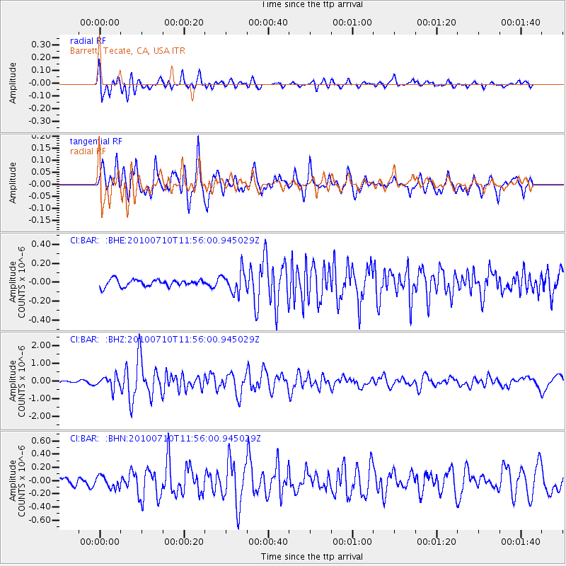
BAR Barrett, Tecate, CA, USA - Earthquake Result Viewer
*The percent match for this event was below the threshold and hence no stack was calculated.
| Earthquake location: |
South Of Mariana Islands |
| Earthquake latitude/longitude: |
11.1/146.0 |
| Earthquake time(UTC): |
2010/07/10 (191) 11:43:32 GMT |
| Earthquake Depth: |
13 km |
| Earthquake Magnitude: |
6.2 MB, 6.1 MS, 6.3 MW, 6.3 MW |
| Earthquake Catalog/Contributor: |
WHDF/NEIC |
|
| Network: |
CI Caltech Regional Seismic Network |
| Station: |
BAR Barrett, Tecate, CA, USA |
| Lat/Lon: |
32.68 N/116.67 W |
| Elevation: |
521 m |
|
| Distance: |
90.1 deg |
| Az: |
56.767 deg |
| Baz: |
283.25 deg |
| Ray Param: |
$rayparam |
*The percent match for this event was below the threshold and hence was not used in the summary stack. |
|
| Radial Match: |
80.87816 % |
| Radial Bump: |
400 |
| Transverse Match: |
82.57771 % |
| Transverse Bump: |
400 |
| SOD ConfigId: |
319893 |
| Insert Time: |
2011-01-05 01:29:33.647 +0000 |
| GWidth: |
2.5 |
| Max Bumps: |
400 |
| Tol: |
0.001 |
|
Signal To Noise
| Channel | StoN | STA | LTA |
| CI:BAR: :BHZ:20100710T11:56:00.945029Z | 3.5356755 | 3.3585383E-7 | 9.499E-8 |
| CI:BAR: :BHN:20100710T11:56:00.945029Z | 1.4627326 | 8.92787E-8 | 6.103556E-8 |
| CI:BAR: :BHE:20100710T11:56:00.945029Z | 3.1452084 | 1.14071085E-7 | 3.626821E-8 |
| Arrivals |
| Ps | |
| PpPs | |
| PsPs/PpSs | |


