You are here: Home > Network List > US - United States National Seismic Network Stations List
> Station EGMT Eagleton, Montana, USA > Earthquake Result Viewer
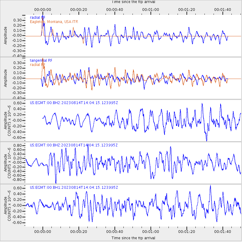
EGMT Eagleton, Montana, USA - Earthquake Result Viewer
*The percent match for this event was below the threshold and hence no stack was calculated.
| Earthquake location: |
South Of Mariana Islands |
| Earthquake latitude/longitude: |
13.4/147.5 |
| Earthquake time(UTC): |
2023/08/14 (226) 13:51:54 GMT |
| Earthquake Depth: |
10 km |
| Earthquake Magnitude: |
6.1 mww |
| Earthquake Catalog/Contributor: |
NEIC PDE/us |
|
| Network: |
US United States National Seismic Network |
| Station: |
EGMT Eagleton, Montana, USA |
| Lat/Lon: |
48.02 N/109.75 W |
| Elevation: |
1055 m |
|
| Distance: |
88.5 deg |
| Az: |
40.928 deg |
| Baz: |
288.245 deg |
| Ray Param: |
$rayparam |
*The percent match for this event was below the threshold and hence was not used in the summary stack. |
|
| Radial Match: |
67.55826 % |
| Radial Bump: |
400 |
| Transverse Match: |
47.865913 % |
| Transverse Bump: |
400 |
| SOD ConfigId: |
31937991 |
| Insert Time: |
2023-08-28 14:15:33.967 +0000 |
| GWidth: |
2.5 |
| Max Bumps: |
400 |
| Tol: |
0.001 |
|
Signal To Noise
| Channel | StoN | STA | LTA |
| US:EGMT:00:BHZ:20230814T14:04:15.123995Z | 1.9924861 | 2.4203672E-7 | 1.2147473E-7 |
| US:EGMT:00:BH1:20230814T14:04:15.123995Z | 0.65844166 | 5.8664913E-8 | 8.90966E-8 |
| US:EGMT:00:BH2:20230814T14:04:15.123995Z | 0.6450892 | 8.487396E-8 | 1.3156934E-7 |
| Arrivals |
| Ps | |
| PpPs | |
| PsPs/PpSs | |


