You are here: Home > Network List > US - United States National Seismic Network Stations List
> Station DGMT Dagmar, Montana, USA > Earthquake Result Viewer
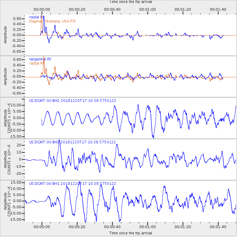
DGMT Dagmar, Montana, USA - Earthquake Result Viewer
*The percent match for this event was below the threshold and hence no stack was calculated.
| Earthquake location: |
Komandorskiye Ostrova Region |
| Earthquake latitude/longitude: |
54.8/164.8 |
| Earthquake time(UTC): |
2018/12/20 (354) 17:01:56 GMT |
| Earthquake Depth: |
33 km |
| Earthquake Magnitude: |
7.3 Mi |
| Earthquake Catalog/Contributor: |
NEIC PDE/pt |
|
| Network: |
US United States National Seismic Network |
| Station: |
DGMT Dagmar, Montana, USA |
| Lat/Lon: |
48.47 N/104.20 W |
| Elevation: |
0.0 m |
|
| Distance: |
53.0 deg |
| Az: |
56.47 deg |
| Baz: |
313.582 deg |
| Ray Param: |
$rayparam |
*The percent match for this event was below the threshold and hence was not used in the summary stack. |
|
| Radial Match: |
86.85567 % |
| Radial Bump: |
270 |
| Transverse Match: |
74.27739 % |
| Transverse Bump: |
400 |
| SOD ConfigId: |
3201911 |
| Insert Time: |
2019-01-03 17:18:15.973 +0000 |
| GWidth: |
2.5 |
| Max Bumps: |
400 |
| Tol: |
0.001 |
|
Signal To Noise
| Channel | StoN | STA | LTA |
| US:DGMT:00:BHZ:20181220T17:10:38.575012Z | 6.0400386 | 5.377048E-6 | 8.902341E-7 |
| US:DGMT:00:BH1:20181220T17:10:38.575012Z | 0.9854396 | 1.9845652E-6 | 2.0138882E-6 |
| US:DGMT:00:BH2:20181220T17:10:38.575012Z | 0.70922965 | 2.5242052E-6 | 3.5590801E-6 |
| Arrivals |
| Ps | |
| PpPs | |
| PsPs/PpSs | |


