You are here: Home > Network List > US - United States National Seismic Network Stations List
> Station ERPA Erie, Pennsylvania, USA > Earthquake Result Viewer
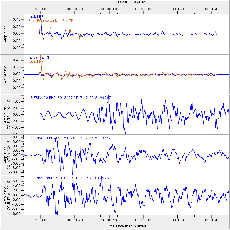
ERPA Erie, Pennsylvania, USA - Earthquake Result Viewer
*The percent match for this event was below the threshold and hence no stack was calculated.
| Earthquake location: |
Komandorskiye Ostrova Region |
| Earthquake latitude/longitude: |
54.8/164.8 |
| Earthquake time(UTC): |
2018/12/20 (354) 17:01:56 GMT |
| Earthquake Depth: |
33 km |
| Earthquake Magnitude: |
7.3 Mi |
| Earthquake Catalog/Contributor: |
NEIC PDE/pt |
|
| Network: |
US United States National Seismic Network |
| Station: |
ERPA Erie, Pennsylvania, USA |
| Lat/Lon: |
42.12 N/79.99 W |
| Elevation: |
306 m |
|
| Distance: |
68.8 deg |
| Az: |
46.243 deg |
| Baz: |
325.845 deg |
| Ray Param: |
$rayparam |
*The percent match for this event was below the threshold and hence was not used in the summary stack. |
|
| Radial Match: |
79.64909 % |
| Radial Bump: |
357 |
| Transverse Match: |
68.067055 % |
| Transverse Bump: |
400 |
| SOD ConfigId: |
3201911 |
| Insert Time: |
2019-01-03 17:18:23.061 +0000 |
| GWidth: |
2.5 |
| Max Bumps: |
400 |
| Tol: |
0.001 |
|
Signal To Noise
| Channel | StoN | STA | LTA |
| US:ERPA:00:BHZ:20181220T17:12:25.849976Z | 7.9707355 | 5.3652493E-6 | 6.7311845E-7 |
| US:ERPA:00:BH1:20181220T17:12:25.849976Z | 3.5979908 | 2.5224092E-6 | 7.010605E-7 |
| US:ERPA:00:BH2:20181220T17:12:25.849976Z | 1.7866006 | 1.315252E-6 | 7.361757E-7 |
| Arrivals |
| Ps | |
| PpPs | |
| PsPs/PpSs | |


