You are here: Home > Network List > TA - USArray Transportable Network (new EarthScope stations) Stations List
> Station E22A Miles City, MT, USA > Earthquake Result Viewer
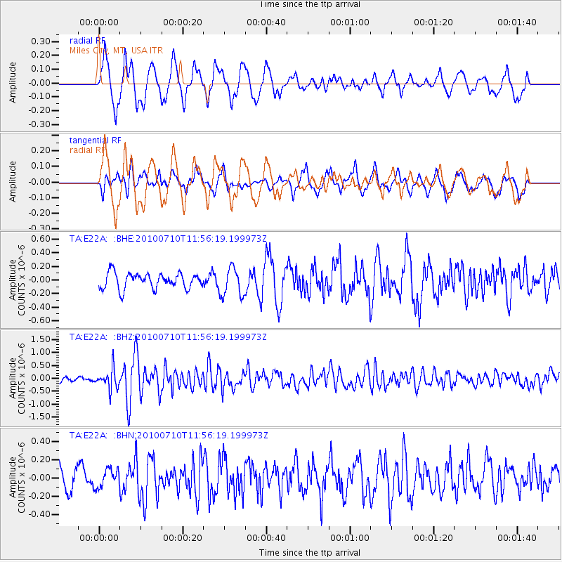
E22A Miles City, MT, USA - Earthquake Result Viewer
*The percent match for this event was below the threshold and hence no stack was calculated.
| Earthquake location: |
South Of Mariana Islands |
| Earthquake latitude/longitude: |
11.1/146.0 |
| Earthquake time(UTC): |
2010/07/10 (191) 11:43:32 GMT |
| Earthquake Depth: |
13 km |
| Earthquake Magnitude: |
6.2 MB, 6.1 MS, 6.3 MW, 6.3 MW |
| Earthquake Catalog/Contributor: |
WHDF/NEIC |
|
| Network: |
TA USArray Transportable Network (new EarthScope stations) |
| Station: |
E22A Miles City, MT, USA |
| Lat/Lon: |
46.44 N/105.95 W |
| Elevation: |
784 m |
|
| Distance: |
94.1 deg |
| Az: |
41.24 deg |
| Baz: |
290.693 deg |
| Ray Param: |
$rayparam |
*The percent match for this event was below the threshold and hence was not used in the summary stack. |
|
| Radial Match: |
75.632996 % |
| Radial Bump: |
400 |
| Transverse Match: |
67.83628 % |
| Transverse Bump: |
400 |
| SOD ConfigId: |
319893 |
| Insert Time: |
2011-01-05 01:43:05.841 +0000 |
| GWidth: |
2.5 |
| Max Bumps: |
400 |
| Tol: |
0.001 |
|
Signal To Noise
| Channel | StoN | STA | LTA |
| TA:E22A: :BHZ:20100710T11:56:19.199973Z | 3.8835096 | 3.8986713E-7 | 1.0039041E-7 |
| TA:E22A: :BHN:20100710T11:56:19.199973Z | 1.1065798 | 9.7112974E-8 | 8.775958E-8 |
| TA:E22A: :BHE:20100710T11:56:19.199973Z | 1.8494309 | 2.1018333E-7 | 1.1364757E-7 |
| Arrivals |
| Ps | |
| PpPs | |
| PsPs/PpSs | |


