You are here: Home > Network List > TA - USArray Transportable Network (new EarthScope stations) Stations List
> Station G27A Dupree, SD, USA > Earthquake Result Viewer
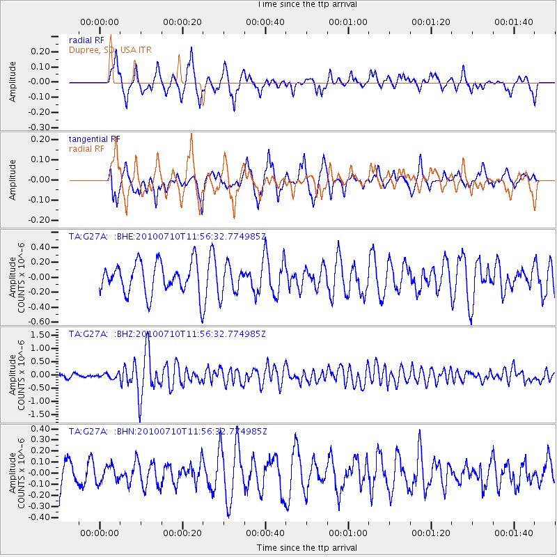
G27A Dupree, SD, USA - Earthquake Result Viewer
*The percent match for this event was below the threshold and hence no stack was calculated.
| Earthquake location: |
South Of Mariana Islands |
| Earthquake latitude/longitude: |
11.1/146.0 |
| Earthquake time(UTC): |
2010/07/10 (191) 11:43:32 GMT |
| Earthquake Depth: |
13 km |
| Earthquake Magnitude: |
6.2 MB, 6.1 MS, 6.3 MW, 6.3 MW |
| Earthquake Catalog/Contributor: |
WHDF/NEIC |
|
| Network: |
TA USArray Transportable Network (new EarthScope stations) |
| Station: |
G27A Dupree, SD, USA |
| Lat/Lon: |
45.38 N/102.93 W |
| Elevation: |
761 m |
|
| Distance: |
96.5 deg |
| Az: |
41.443 deg |
| Baz: |
292.835 deg |
| Ray Param: |
$rayparam |
*The percent match for this event was below the threshold and hence was not used in the summary stack. |
|
| Radial Match: |
66.203674 % |
| Radial Bump: |
400 |
| Transverse Match: |
67.18299 % |
| Transverse Bump: |
379 |
| SOD ConfigId: |
319893 |
| Insert Time: |
2011-01-05 01:44:10.867 +0000 |
| GWidth: |
2.5 |
| Max Bumps: |
400 |
| Tol: |
0.001 |
|
Signal To Noise
| Channel | StoN | STA | LTA |
| TA:G27A: :BHZ:20100710T11:56:32.774985Z | 1.2199527 | 8.876893E-8 | 7.276424E-8 |
| TA:G27A: :BHN:20100710T11:56:32.774985Z | 0.46427423 | 7.2801036E-8 | 1.5680611E-7 |
| TA:G27A: :BHE:20100710T11:56:32.774985Z | 1.5171248 | 2.7006823E-7 | 1.780132E-7 |
| Arrivals |
| Ps | |
| PpPs | |
| PsPs/PpSs | |


