You are here: Home > Network List > TA - USArray Transportable Network (new EarthScope stations) Stations List
> Station D27A Center, ND, USA > Earthquake Result Viewer
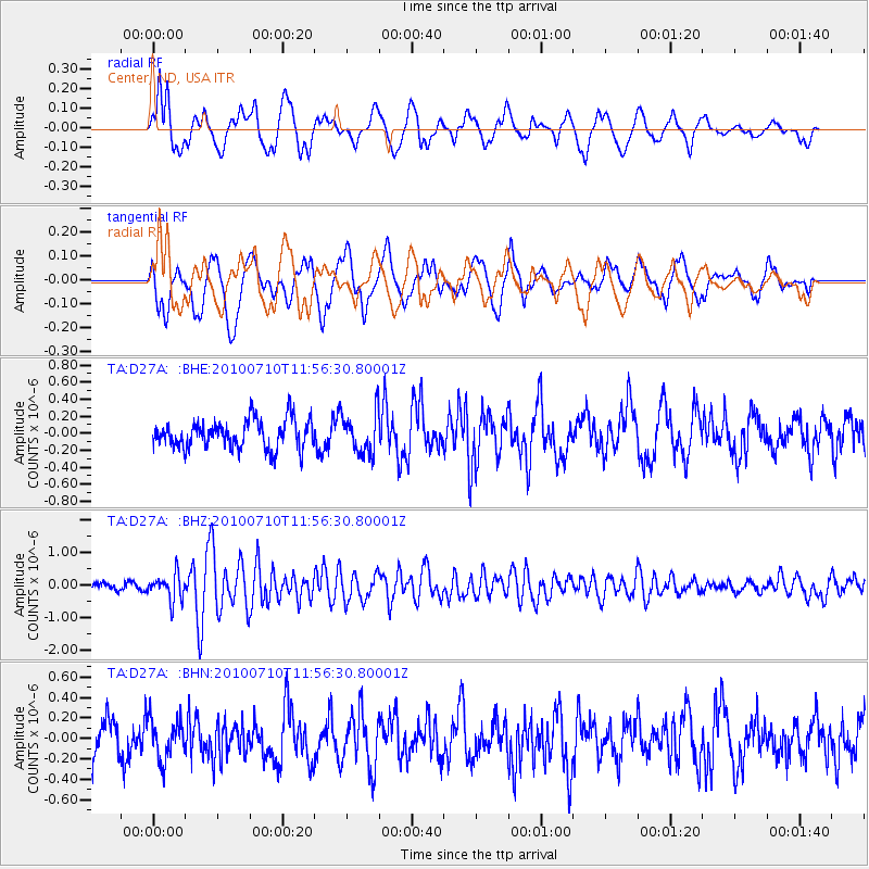
D27A Center, ND, USA - Earthquake Result Viewer
*The percent match for this event was below the threshold and hence no stack was calculated.
| Earthquake location: |
South Of Mariana Islands |
| Earthquake latitude/longitude: |
11.1/146.0 |
| Earthquake time(UTC): |
2010/07/10 (191) 11:43:32 GMT |
| Earthquake Depth: |
13 km |
| Earthquake Magnitude: |
6.2 MB, 6.1 MS, 6.3 MW, 6.3 MW |
| Earthquake Catalog/Contributor: |
WHDF/NEIC |
|
| Network: |
TA USArray Transportable Network (new EarthScope stations) |
| Station: |
D27A Center, ND, USA |
| Lat/Lon: |
47.11 N/101.53 W |
| Elevation: |
685 m |
|
| Distance: |
96.7 deg |
| Az: |
39.455 deg |
| Baz: |
294.075 deg |
| Ray Param: |
$rayparam |
*The percent match for this event was below the threshold and hence was not used in the summary stack. |
|
| Radial Match: |
63.209488 % |
| Radial Bump: |
400 |
| Transverse Match: |
72.31953 % |
| Transverse Bump: |
400 |
| SOD ConfigId: |
319893 |
| Insert Time: |
2011-01-05 01:44:35.062 +0000 |
| GWidth: |
2.5 |
| Max Bumps: |
400 |
| Tol: |
0.001 |
|
Signal To Noise
| Channel | StoN | STA | LTA |
| TA:D27A: :BHZ:20100710T11:56:30.80001Z | 2.9508302 | 3.970329E-7 | 1.3454955E-7 |
| TA:D27A: :BHN:20100710T11:56:30.80001Z | 1.1833835 | 1.938159E-7 | 1.6378115E-7 |
| TA:D27A: :BHE:20100710T11:56:30.80001Z | 1.4223038 | 2.395427E-7 | 1.684188E-7 |
| Arrivals |
| Ps | |
| PpPs | |
| PsPs/PpSs | |


