You are here: Home > Network List > TA - USArray Transportable Network (new EarthScope stations) Stations List
> Station D26A Manning, ND, USA > Earthquake Result Viewer
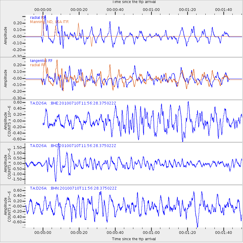
D26A Manning, ND, USA - Earthquake Result Viewer
*The percent match for this event was below the threshold and hence no stack was calculated.
| Earthquake location: |
South Of Mariana Islands |
| Earthquake latitude/longitude: |
11.1/146.0 |
| Earthquake time(UTC): |
2010/07/10 (191) 11:43:32 GMT |
| Earthquake Depth: |
13 km |
| Earthquake Magnitude: |
6.2 MB, 6.1 MS, 6.3 MW, 6.3 MW |
| Earthquake Catalog/Contributor: |
WHDF/NEIC |
|
| Network: |
TA USArray Transportable Network (new EarthScope stations) |
| Station: |
D26A Manning, ND, USA |
| Lat/Lon: |
47.03 N/102.44 W |
| Elevation: |
693 m |
|
| Distance: |
96.1 deg |
| Az: |
39.779 deg |
| Baz: |
293.374 deg |
| Ray Param: |
$rayparam |
*The percent match for this event was below the threshold and hence was not used in the summary stack. |
|
| Radial Match: |
71.023735 % |
| Radial Bump: |
400 |
| Transverse Match: |
54.302296 % |
| Transverse Bump: |
400 |
| SOD ConfigId: |
319893 |
| Insert Time: |
2011-01-05 01:44:47.430 +0000 |
| GWidth: |
2.5 |
| Max Bumps: |
400 |
| Tol: |
0.001 |
|
Signal To Noise
| Channel | StoN | STA | LTA |
| TA:D26A: :BHZ:20100710T11:56:28.375022Z | 2.6033669 | 2.8101792E-7 | 1.0794403E-7 |
| TA:D26A: :BHN:20100710T11:56:28.375022Z | 1.0877155 | 1.8604126E-7 | 1.7103854E-7 |
| TA:D26A: :BHE:20100710T11:56:28.375022Z | 0.8544065 | 1.2273756E-7 | 1.4365243E-7 |
| Arrivals |
| Ps | |
| PpPs | |
| PsPs/PpSs | |


