You are here: Home > Network List > AK - Alaska Regional Network Stations List
> Station MDM Murphy Dome > Earthquake Result Viewer
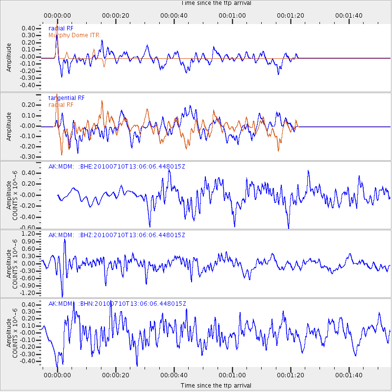
MDM Murphy Dome - Earthquake Result Viewer
*The percent match for this event was below the threshold and hence no stack was calculated.
| Earthquake location: |
Solomon Islands |
| Earthquake latitude/longitude: |
-7.9/158.7 |
| Earthquake time(UTC): |
2010/07/10 (191) 12:54:19 GMT |
| Earthquake Depth: |
47 km |
| Earthquake Magnitude: |
5.7 MB, 5.4 MS, 5.7 MW |
| Earthquake Catalog/Contributor: |
WHDF/NEIC |
|
| Network: |
AK Alaska Regional Network |
| Station: |
MDM Murphy Dome |
| Lat/Lon: |
64.96 N/148.23 W |
| Elevation: |
634 m |
|
| Distance: |
82.5 deg |
| Az: |
20.067 deg |
| Baz: |
233.005 deg |
| Ray Param: |
$rayparam |
*The percent match for this event was below the threshold and hence was not used in the summary stack. |
|
| Radial Match: |
58.78535 % |
| Radial Bump: |
350 |
| Transverse Match: |
71.59222 % |
| Transverse Bump: |
400 |
| SOD ConfigId: |
319893 |
| Insert Time: |
2011-01-05 01:51:12.544 +0000 |
| GWidth: |
2.5 |
| Max Bumps: |
400 |
| Tol: |
0.001 |
|
Signal To Noise
| Channel | StoN | STA | LTA |
| AK:MDM: :BHZ:20100710T13:06:06.448015Z | 3.6040792 | 5.2744616E-7 | 1.4634699E-7 |
| AK:MDM: :BHN:20100710T13:06:06.448015Z | 2.5046854 | 3.0086457E-7 | 1.201207E-7 |
| AK:MDM: :BHE:20100710T13:06:06.448015Z | 2.4217465 | 2.0781606E-7 | 8.581248E-8 |
| Arrivals |
| Ps | |
| PpPs | |
| PsPs/PpSs | |


