You are here: Home > Network List > AZ - ANZA Regional Network Stations List
> Station SMER AZ.SMER > Earthquake Result Viewer
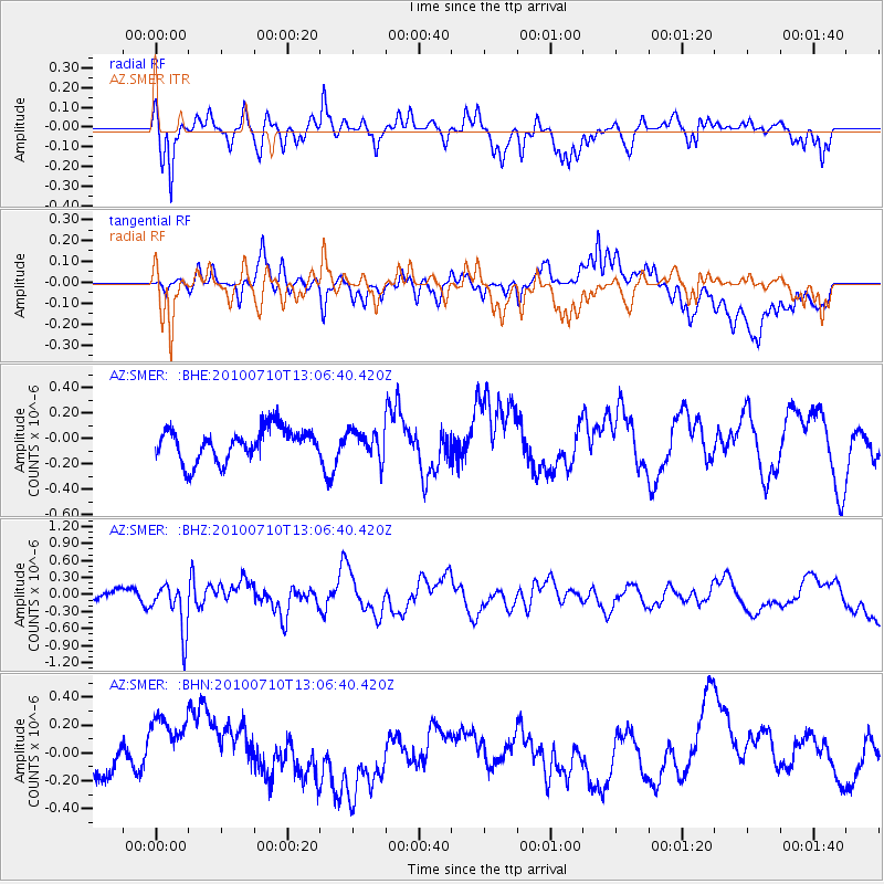
SMER AZ.SMER - Earthquake Result Viewer
*The percent match for this event was below the threshold and hence no stack was calculated.
| Earthquake location: |
Solomon Islands |
| Earthquake latitude/longitude: |
-7.9/158.7 |
| Earthquake time(UTC): |
2010/07/10 (191) 12:54:19 GMT |
| Earthquake Depth: |
47 km |
| Earthquake Magnitude: |
5.7 MB, 5.4 MS, 5.7 MW |
| Earthquake Catalog/Contributor: |
WHDF/NEIC |
|
| Network: |
AZ ANZA Regional Network |
| Station: |
SMER AZ.SMER |
| Lat/Lon: |
33.46 N/117.17 W |
| Elevation: |
355 m |
|
| Distance: |
89.4 deg |
| Az: |
56.267 deg |
| Baz: |
260.252 deg |
| Ray Param: |
$rayparam |
*The percent match for this event was below the threshold and hence was not used in the summary stack. |
|
| Radial Match: |
65.12101 % |
| Radial Bump: |
348 |
| Transverse Match: |
41.542664 % |
| Transverse Bump: |
400 |
| SOD ConfigId: |
319893 |
| Insert Time: |
2011-01-05 01:52:18.846 +0000 |
| GWidth: |
2.5 |
| Max Bumps: |
400 |
| Tol: |
0.001 |
|
Signal To Noise
| Channel | StoN | STA | LTA |
| AZ:SMER: :BHZ:20100710T13:06:40.420Z | 3.953338 | 4.247188E-7 | 1.0743296E-7 |
| AZ:SMER: :BHN:20100710T13:06:40.420Z | 1.1761928 | 2.5221175E-7 | 2.1443063E-7 |
| AZ:SMER: :BHE:20100710T13:06:40.420Z | 0.8000282 | 9.9780586E-8 | 1.2472134E-7 |
| Arrivals |
| Ps | |
| PpPs | |
| PsPs/PpSs | |


