You are here: Home > Network List > US - United States National Seismic Network Stations List
> Station TPNV Topopah Spring, Nevada, USA > Earthquake Result Viewer
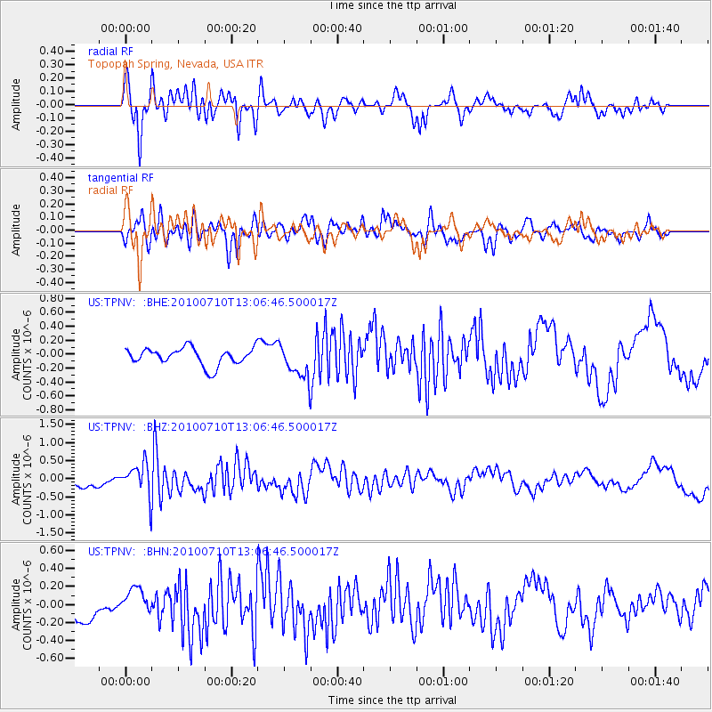
TPNV Topopah Spring, Nevada, USA - Earthquake Result Viewer
*The percent match for this event was below the threshold and hence no stack was calculated.
| Earthquake location: |
Solomon Islands |
| Earthquake latitude/longitude: |
-7.9/158.7 |
| Earthquake time(UTC): |
2010/07/10 (191) 12:54:19 GMT |
| Earthquake Depth: |
47 km |
| Earthquake Magnitude: |
5.7 MB, 5.4 MS, 5.7 MW |
| Earthquake Catalog/Contributor: |
WHDF/NEIC |
|
| Network: |
US United States National Seismic Network |
| Station: |
TPNV Topopah Spring, Nevada, USA |
| Lat/Lon: |
36.95 N/116.25 W |
| Elevation: |
1600 m |
|
| Distance: |
90.7 deg |
| Az: |
52.956 deg |
| Baz: |
260.785 deg |
| Ray Param: |
$rayparam |
*The percent match for this event was below the threshold and hence was not used in the summary stack. |
|
| Radial Match: |
65.081795 % |
| Radial Bump: |
400 |
| Transverse Match: |
46.171787 % |
| Transverse Bump: |
400 |
| SOD ConfigId: |
319893 |
| Insert Time: |
2011-01-05 01:55:51.914 +0000 |
| GWidth: |
2.5 |
| Max Bumps: |
400 |
| Tol: |
0.001 |
|
Signal To Noise
| Channel | StoN | STA | LTA |
| US:TPNV: :BHZ:20100710T13:06:46.500017Z | 2.5262132 | 4.4669196E-7 | 1.7682274E-7 |
| US:TPNV: :BHN:20100710T13:06:46.500017Z | 0.8083252 | 1.6394993E-7 | 2.0282671E-7 |
| US:TPNV: :BHE:20100710T13:06:46.500017Z | 2.0483415 | 2.5376502E-7 | 1.2388804E-7 |
| Arrivals |
| Ps | |
| PpPs | |
| PsPs/PpSs | |


