You are here: Home > Network List > UW - Pacific Northwest Regional Seismic Network Stations List
> Station FISH Seaside, OR, USA > Earthquake Result Viewer
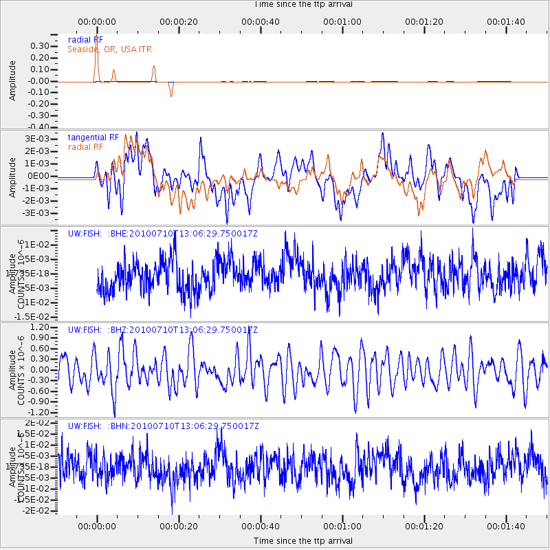
FISH Seaside, OR, USA - Earthquake Result Viewer
*The percent match for this event was below the threshold and hence no stack was calculated.
| Earthquake location: |
Solomon Islands |
| Earthquake latitude/longitude: |
-7.9/158.7 |
| Earthquake time(UTC): |
2010/07/10 (191) 12:54:19 GMT |
| Earthquake Depth: |
47 km |
| Earthquake Magnitude: |
5.7 MB, 5.4 MS, 5.7 MW |
| Earthquake Catalog/Contributor: |
WHDF/NEIC |
|
| Network: |
UW Pacific Northwest Regional Seismic Network |
| Station: |
FISH Seaside, OR, USA |
| Lat/Lon: |
45.93 N/123.56 W |
| Elevation: |
325 m |
|
| Distance: |
87.2 deg |
| Az: |
43.066 deg |
| Baz: |
255.764 deg |
| Ray Param: |
$rayparam |
*The percent match for this event was below the threshold and hence was not used in the summary stack. |
|
| Radial Match: |
58.239895 % |
| Radial Bump: |
400 |
| Transverse Match: |
52.217182 % |
| Transverse Bump: |
400 |
| SOD ConfigId: |
319893 |
| Insert Time: |
2011-01-05 01:56:20.307 +0000 |
| GWidth: |
2.5 |
| Max Bumps: |
400 |
| Tol: |
0.001 |
|
Signal To Noise
| Channel | StoN | STA | LTA |
| UW:FISH: :BHZ:20100710T13:06:29.750017Z | 1.3270924 | 5.2576917E-7 | 3.9618126E-7 |
| UW:FISH: :BHN:20100710T13:06:29.750017Z | 0.88896656 | 5.0795403E-9 | 5.7139835E-9 |
| UW:FISH: :BHE:20100710T13:06:29.750017Z | 1.1804155 | 6.039405E-9 | 5.1163385E-9 |
| Arrivals |
| Ps | |
| PpPs | |
| PsPs/PpSs | |


