You are here: Home > Network List > GS - US Geological Survey Networks Stations List
> Station KAN10 Keim Farm > Earthquake Result Viewer
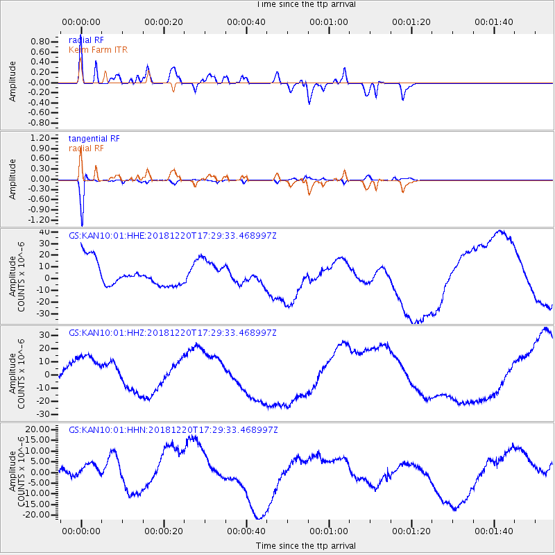
KAN10 Keim Farm - Earthquake Result Viewer
*The percent match for this event was below the threshold and hence no stack was calculated.
| Earthquake location: |
Komandorskiye Ostrova Region |
| Earthquake latitude/longitude: |
55.1/164.9 |
| Earthquake time(UTC): |
2018/12/20 (354) 17:19:29 GMT |
| Earthquake Depth: |
10 km |
| Earthquake Magnitude: |
5.6 mb |
| Earthquake Catalog/Contributor: |
NEIC PDE/us |
|
| Network: |
GS US Geological Survey Networks |
| Station: |
KAN10 Keim Farm |
| Lat/Lon: |
37.12 N/98.10 W |
| Elevation: |
417 m |
|
| Distance: |
64.2 deg |
| Az: |
61.776 deg |
| Baz: |
320.649 deg |
| Ray Param: |
$rayparam |
*The percent match for this event was below the threshold and hence was not used in the summary stack. |
|
| Radial Match: |
67.7884 % |
| Radial Bump: |
400 |
| Transverse Match: |
95.22673 % |
| Transverse Bump: |
210 |
| SOD ConfigId: |
3201911 |
| Insert Time: |
2019-01-03 17:22:59.188 +0000 |
| GWidth: |
2.5 |
| Max Bumps: |
400 |
| Tol: |
0.001 |
|
Signal To Noise
| Channel | StoN | STA | LTA |
| GS:KAN10:01:HHZ:20181220T17:29:33.468997Z | 3.5304544 | 1.861724E-5 | 5.2733267E-6 |
| GS:KAN10:01:HHN:20181220T17:29:33.468997Z | 1.5349628 | 9.13182E-6 | 5.9492127E-6 |
| GS:KAN10:01:HHE:20181220T17:29:33.468997Z | 1.1204859 | 1.1203953E-5 | 9.999192E-6 |
| Arrivals |
| Ps | |
| PpPs | |
| PsPs/PpSs | |


