You are here: Home > Network List > IW - Intermountain West Stations List
> Station MOOW Moose Ponds, Wyoming, USA > Earthquake Result Viewer
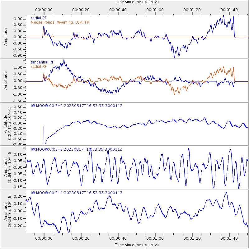
MOOW Moose Ponds, Wyoming, USA - Earthquake Result Viewer
*The percent match for this event was below the threshold and hence no stack was calculated.
| Earthquake location: |
Central Mid-Atlantic Ridge |
| Earthquake latitude/longitude: |
-0.3/-19.6 |
| Earthquake time(UTC): |
2023/08/17 (229) 16:41:02 GMT |
| Earthquake Depth: |
10 km |
| Earthquake Magnitude: |
6.0 Mww |
| Earthquake Catalog/Contributor: |
NEIC PDE/us |
|
| Network: |
IW Intermountain West |
| Station: |
MOOW Moose Ponds, Wyoming, USA |
| Lat/Lon: |
43.75 N/110.74 W |
| Elevation: |
2128 m |
|
| Distance: |
91.1 deg |
| Az: |
313.559 deg |
| Baz: |
89.411 deg |
| Ray Param: |
$rayparam |
*The percent match for this event was below the threshold and hence was not used in the summary stack. |
|
| Radial Match: |
26.271597 % |
| Radial Bump: |
400 |
| Transverse Match: |
40.43013 % |
| Transverse Bump: |
400 |
| SOD ConfigId: |
31937991 |
| Insert Time: |
2023-08-31 16:52:25.509 +0000 |
| GWidth: |
2.5 |
| Max Bumps: |
400 |
| Tol: |
0.001 |
|
Signal To Noise
| Channel | StoN | STA | LTA |
| IW:MOOW:00:BHZ:20230817T16:53:35.300011Z | 1.2359983 | 6.549169E-8 | 5.298688E-8 |
| IW:MOOW:00:BH1:20230817T16:53:35.300011Z | 2.5133398 | 2.9756842E-7 | 1.1839562E-7 |
| IW:MOOW:00:BH2:20230817T16:53:35.300011Z | 0.4541257 | 1.1333373E-7 | 2.4956466E-7 |
| Arrivals |
| Ps | |
| PpPs | |
| PsPs/PpSs | |


