You are here: Home > Network List > US - United States National Seismic Network Stations List
> Station EGMT Eagleton, Montana, USA > Earthquake Result Viewer
EGMT Eagleton, Montana, USA - Earthquake Result Viewer
*The percent match for this event was below the threshold and hence no stack was calculated.
| Earthquake location: |
Central Mid-Atlantic Ridge |
| Earthquake latitude/longitude: |
-0.3/-19.6 |
| Earthquake time(UTC): |
2023/08/17 (229) 16:41:02 GMT |
| Earthquake Depth: |
10 km |
| Earthquake Magnitude: |
6.0 Mww |
| Earthquake Catalog/Contributor: |
NEIC PDE/us |
|
| Network: |
US United States National Seismic Network |
| Station: |
EGMT Eagleton, Montana, USA |
| Lat/Lon: |
48.02 N/109.75 W |
| Elevation: |
1055 m |
|
| Distance: |
90.3 deg |
| Az: |
317.832 deg |
| Baz: |
90.068 deg |
| Ray Param: |
$rayparam |
*The percent match for this event was below the threshold and hence was not used in the summary stack. |
|
| Radial Match: |
58.353855 % |
| Radial Bump: |
400 |
| Transverse Match: |
46.47292 % |
| Transverse Bump: |
400 |
| SOD ConfigId: |
31937991 |
| Insert Time: |
2023-08-31 17:02:37.026 +0000 |
| GWidth: |
2.5 |
| Max Bumps: |
400 |
| Tol: |
0.001 |
|
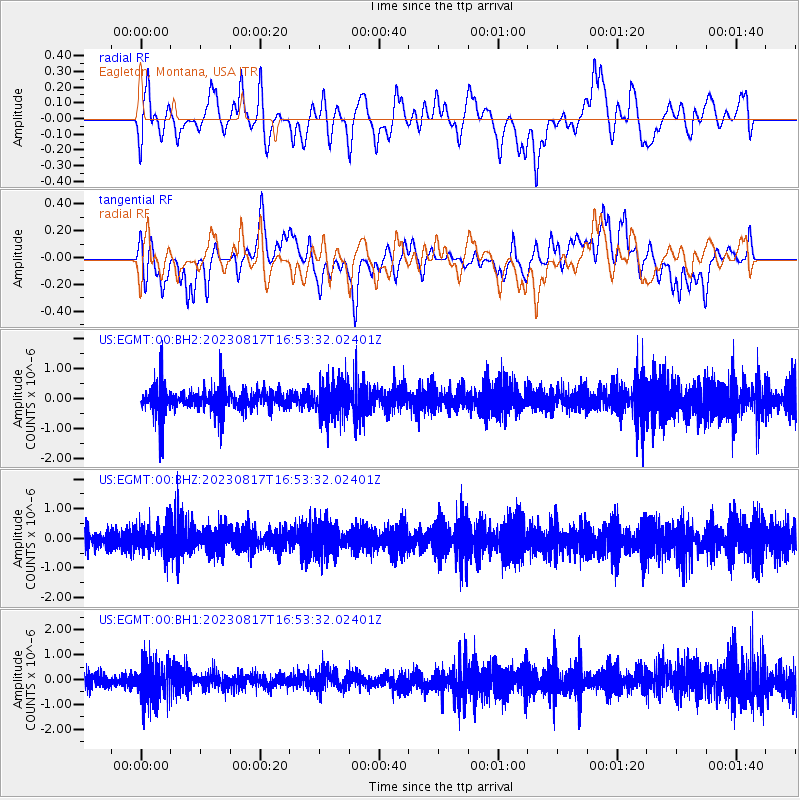
Signal To Noise
| Channel | StoN | STA | LTA |
| US:EGMT:00:BHZ:20230817T16:53:32.02401Z | 1.1807227 | 4.427193E-7 | 3.7495622E-7 |
| US:EGMT:00:BH1:20230817T16:53:32.02401Z | 1.9263194 | 8.1005226E-7 | 4.2051815E-7 |
| US:EGMT:00:BH2:20230817T16:53:32.02401Z | 1.3866374 | 5.873056E-7 | 4.2354657E-7 |
| Arrivals |
| Ps | |
| PpPs | |
| PsPs/PpSs | |


