You are here: Home > Network List > US - United States National Seismic Network Stations List
> Station CBKS Cedar Bluff, Kansas, USA > Earthquake Result Viewer
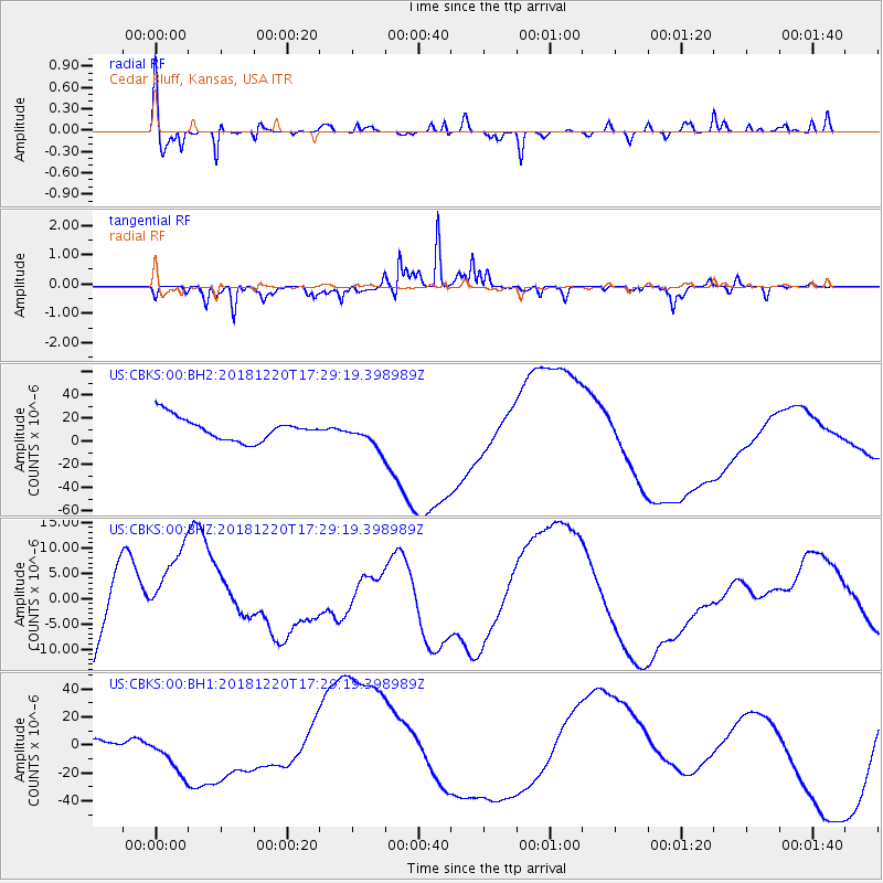
CBKS Cedar Bluff, Kansas, USA - Earthquake Result Viewer
*The percent match for this event was below the threshold and hence no stack was calculated.
| Earthquake location: |
Komandorskiye Ostrova Region |
| Earthquake latitude/longitude: |
55.1/164.9 |
| Earthquake time(UTC): |
2018/12/20 (354) 17:19:29 GMT |
| Earthquake Depth: |
10 km |
| Earthquake Magnitude: |
5.6 mb |
| Earthquake Catalog/Contributor: |
NEIC PDE/us |
|
| Network: |
US United States National Seismic Network |
| Station: |
CBKS Cedar Bluff, Kansas, USA |
| Lat/Lon: |
38.81 N/99.74 W |
| Elevation: |
677 m |
|
| Distance: |
62.1 deg |
| Az: |
61.68 deg |
| Baz: |
319.6 deg |
| Ray Param: |
$rayparam |
*The percent match for this event was below the threshold and hence was not used in the summary stack. |
|
| Radial Match: |
72.50108 % |
| Radial Bump: |
400 |
| Transverse Match: |
77.34753 % |
| Transverse Bump: |
236 |
| SOD ConfigId: |
3201911 |
| Insert Time: |
2019-01-03 17:26:08.261 +0000 |
| GWidth: |
2.5 |
| Max Bumps: |
400 |
| Tol: |
0.001 |
|
Signal To Noise
| Channel | StoN | STA | LTA |
| US:CBKS:00:BHZ:20181220T17:29:19.398989Z | 0.56610835 | 7.7340055E-6 | 1.36617045E-5 |
| US:CBKS:00:BH1:20181220T17:29:19.398989Z | 4.6913342 | 2.0184369E-5 | 4.3024793E-6 |
| US:CBKS:00:BH2:20181220T17:29:19.398989Z | 1.1709038 | 1.1369287E-5 | 9.709838E-6 |
| Arrivals |
| Ps | |
| PpPs | |
| PsPs/PpSs | |


