You are here: Home > Network List > US - United States National Seismic Network Stations List
> Station MIAR Mount Ida, Arkansas, USA > Earthquake Result Viewer
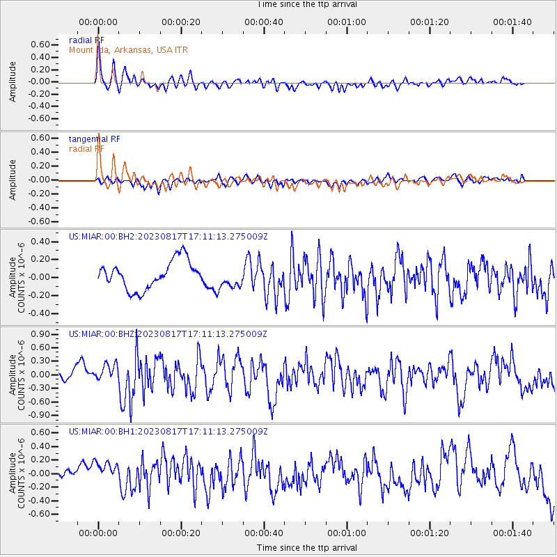
MIAR Mount Ida, Arkansas, USA - Earthquake Result Viewer
*The percent match for this event was below the threshold and hence no stack was calculated.
| Earthquake location: |
Colombia |
| Earthquake latitude/longitude: |
4.4/-73.6 |
| Earthquake time(UTC): |
2023/08/17 (229) 17:04:48 GMT |
| Earthquake Depth: |
10 km |
| Earthquake Magnitude: |
6.2 mww |
| Earthquake Catalog/Contributor: |
NEIC PDE/us |
|
| Network: |
US United States National Seismic Network |
| Station: |
MIAR Mount Ida, Arkansas, USA |
| Lat/Lon: |
34.55 N/93.58 W |
| Elevation: |
207 m |
|
| Distance: |
35.3 deg |
| Az: |
330.736 deg |
| Baz: |
143.807 deg |
| Ray Param: |
$rayparam |
*The percent match for this event was below the threshold and hence was not used in the summary stack. |
|
| Radial Match: |
75.32852 % |
| Radial Bump: |
400 |
| Transverse Match: |
45.18395 % |
| Transverse Bump: |
400 |
| SOD ConfigId: |
31937991 |
| Insert Time: |
2023-08-31 17:30:11.808 +0000 |
| GWidth: |
2.5 |
| Max Bumps: |
400 |
| Tol: |
0.001 |
|
Signal To Noise
| Channel | StoN | STA | LTA |
| US:MIAR:00:BHZ:20230817T17:11:13.275009Z | 1.4768482 | 2.064585E-7 | 1.3979668E-7 |
| US:MIAR:00:BH1:20230817T17:11:13.275009Z | 1.9874878 | 1.8812986E-7 | 9.465712E-8 |
| US:MIAR:00:BH2:20230817T17:11:13.275009Z | 0.77327585 | 1.1931509E-7 | 1.5429822E-7 |
| Arrivals |
| Ps | |
| PpPs | |
| PsPs/PpSs | |


