You are here: Home > Network List > IW - Intermountain West Stations List
> Station MOOW Moose Ponds, Wyoming, USA > Earthquake Result Viewer
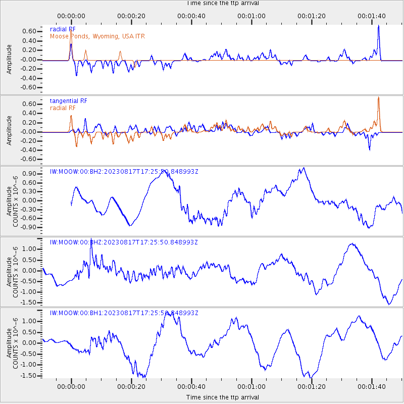
MOOW Moose Ponds, Wyoming, USA - Earthquake Result Viewer
*The percent match for this event was below the threshold and hence no stack was calculated.
| Earthquake location: |
Colombia |
| Earthquake latitude/longitude: |
4.2/-73.6 |
| Earthquake time(UTC): |
2023/08/17 (229) 17:17:18 GMT |
| Earthquake Depth: |
7.9 km |
| Earthquake Magnitude: |
5.7 Mww |
| Earthquake Catalog/Contributor: |
NEIC PDE/us |
|
| Network: |
IW Intermountain West |
| Station: |
MOOW Moose Ponds, Wyoming, USA |
| Lat/Lon: |
43.75 N/110.74 W |
| Elevation: |
2128 m |
|
| Distance: |
51.2 deg |
| Az: |
325.852 deg |
| Baz: |
129.42 deg |
| Ray Param: |
$rayparam |
*The percent match for this event was below the threshold and hence was not used in the summary stack. |
|
| Radial Match: |
45.52018 % |
| Radial Bump: |
400 |
| Transverse Match: |
27.454851 % |
| Transverse Bump: |
400 |
| SOD ConfigId: |
31937991 |
| Insert Time: |
2023-08-31 17:45:43.084 +0000 |
| GWidth: |
2.5 |
| Max Bumps: |
400 |
| Tol: |
0.001 |
|
Signal To Noise
| Channel | StoN | STA | LTA |
| IW:MOOW:00:BHZ:20230817T17:25:50.848993Z | 0.8448019 | 3.1934132E-7 | 3.7800737E-7 |
| IW:MOOW:00:BH1:20230817T17:25:50.848993Z | 2.232473 | 5.2161533E-7 | 2.3364912E-7 |
| IW:MOOW:00:BH2:20230817T17:25:50.848993Z | 3.1781952 | 1.0356889E-6 | 3.258733E-7 |
| Arrivals |
| Ps | |
| PpPs | |
| PsPs/PpSs | |


