You are here: Home > Network List > TA - USArray Transportable Network (new EarthScope stations) Stations List
> Station J21A Lysite, WY, USA > Earthquake Result Viewer
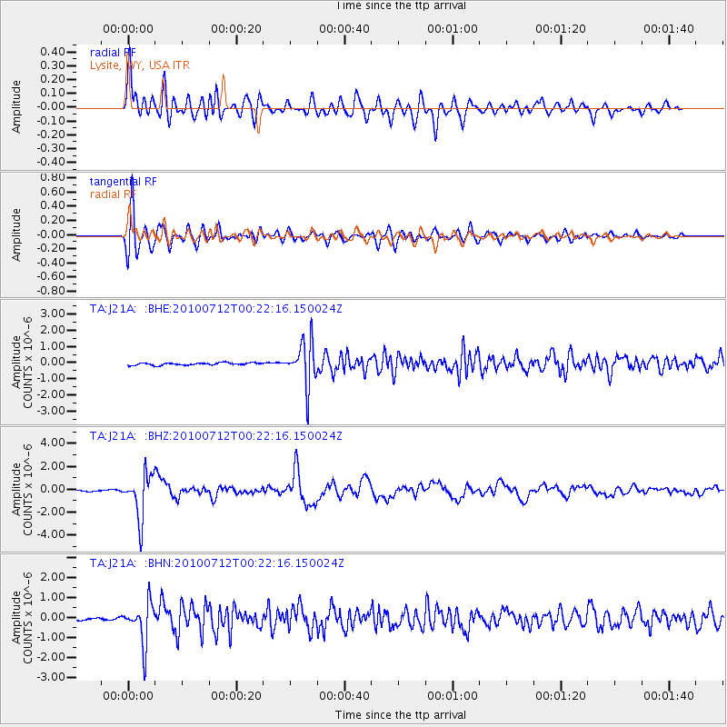
J21A Lysite, WY, USA - Earthquake Result Viewer
*The percent match for this event was below the threshold and hence no stack was calculated.
| Earthquake location: |
Northern Chile |
| Earthquake latitude/longitude: |
-22.1/-68.2 |
| Earthquake time(UTC): |
2010/07/12 (193) 00:11:21 GMT |
| Earthquake Depth: |
115 km |
| Earthquake Magnitude: |
6.1 MB, 6.3 MW, 6.2 MW |
| Earthquake Catalog/Contributor: |
WHDF/NEIC |
|
| Network: |
TA USArray Transportable Network (new EarthScope stations) |
| Station: |
J21A Lysite, WY, USA |
| Lat/Lon: |
43.35 N/107.45 W |
| Elevation: |
1913 m |
|
| Distance: |
74.5 deg |
| Az: |
331.391 deg |
| Baz: |
142.518 deg |
| Ray Param: |
$rayparam |
*The percent match for this event was below the threshold and hence was not used in the summary stack. |
|
| Radial Match: |
88.682495 % |
| Radial Bump: |
400 |
| Transverse Match: |
90.23192 % |
| Transverse Bump: |
400 |
| SOD ConfigId: |
319893 |
| Insert Time: |
2011-01-05 02:13:12.125 +0000 |
| GWidth: |
2.5 |
| Max Bumps: |
400 |
| Tol: |
0.001 |
|
Signal To Noise
| Channel | StoN | STA | LTA |
| TA:J21A: :BHZ:20100712T00:22:16.150024Z | 32.7163 | 1.9430477E-6 | 5.9390814E-8 |
| TA:J21A: :BHN:20100712T00:22:16.150024Z | 13.870825 | 1.0361792E-6 | 7.470206E-8 |
| TA:J21A: :BHE:20100712T00:22:16.150024Z | 18.931622 | 1.3559286E-6 | 7.162242E-8 |
| Arrivals |
| Ps | |
| PpPs | |
| PsPs/PpSs | |


