You are here: Home > Network List > TA - USArray Transportable Network (new EarthScope stations) Stations List
> Station TOLK Toolik Lake Research Station, AK, USA > Earthquake Result Viewer
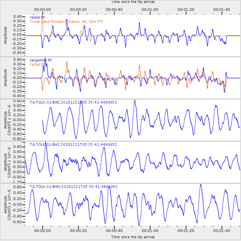
TOLK Toolik Lake Research Station, AK, USA - Earthquake Result Viewer
*The percent match for this event was below the threshold and hence no stack was calculated.
| Earthquake location: |
New Britain Region, P.N.G. |
| Earthquake latitude/longitude: |
-5.6/152.0 |
| Earthquake time(UTC): |
2018/12/21 (355) 05:23:41 GMT |
| Earthquake Depth: |
9.9 km |
| Earthquake Magnitude: |
5.3 Mww |
| Earthquake Catalog/Contributor: |
NEIC PDE/us |
|
| Network: |
TA USArray Transportable Network (new EarthScope stations) |
| Station: |
TOLK Toolik Lake Research Station, AK, USA |
| Lat/Lon: |
68.64 N/149.57 W |
| Elevation: |
760 m |
|
| Distance: |
84.2 deg |
| Az: |
18.28 deg |
| Baz: |
238.453 deg |
| Ray Param: |
$rayparam |
*The percent match for this event was below the threshold and hence was not used in the summary stack. |
|
| Radial Match: |
50.140793 % |
| Radial Bump: |
400 |
| Transverse Match: |
57.91263 % |
| Transverse Bump: |
400 |
| SOD ConfigId: |
3201911 |
| Insert Time: |
2019-01-04 05:26:32.563 +0000 |
| GWidth: |
2.5 |
| Max Bumps: |
400 |
| Tol: |
0.001 |
|
Signal To Noise
| Channel | StoN | STA | LTA |
| TA:TOLK:01:BHZ:20181221T05:35:41.449995Z | 1.936805 | 5.844294E-7 | 3.0174922E-7 |
| TA:TOLK:01:BHN:20181221T05:35:41.449995Z | 0.6712715 | 1.9798672E-7 | 2.9494285E-7 |
| TA:TOLK:01:BHE:20181221T05:35:41.449995Z | 1.0047938 | 4.0490377E-7 | 4.02972E-7 |
| Arrivals |
| Ps | |
| PpPs | |
| PsPs/PpSs | |


