You are here: Home > Network List > US - United States National Seismic Network Stations List
> Station MSO Missoula, Montana, USA > Earthquake Result Viewer
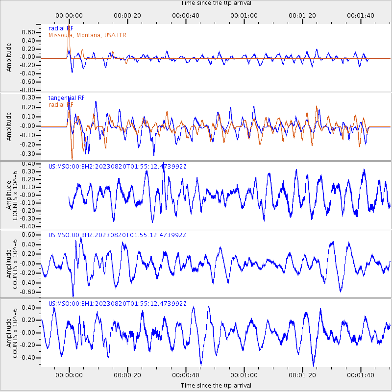
MSO Missoula, Montana, USA - Earthquake Result Viewer
*The percent match for this event was below the threshold and hence no stack was calculated.
| Earthquake location: |
Fox Islands, Aleutian Islands |
| Earthquake latitude/longitude: |
51.6/-167.3 |
| Earthquake time(UTC): |
2023/08/20 (232) 01:48:54 GMT |
| Earthquake Depth: |
10 km |
| Earthquake Magnitude: |
5.2 Mww |
| Earthquake Catalog/Contributor: |
NEIC PDE/us |
|
| Network: |
US United States National Seismic Network |
| Station: |
MSO Missoula, Montana, USA |
| Lat/Lon: |
46.83 N/113.94 W |
| Elevation: |
1264 m |
|
| Distance: |
34.5 deg |
| Az: |
76.478 deg |
| Baz: |
298.078 deg |
| Ray Param: |
$rayparam |
*The percent match for this event was below the threshold and hence was not used in the summary stack. |
|
| Radial Match: |
58.192398 % |
| Radial Bump: |
400 |
| Transverse Match: |
71.2709 % |
| Transverse Bump: |
400 |
| SOD ConfigId: |
31937991 |
| Insert Time: |
2023-09-03 02:12:30.962 +0000 |
| GWidth: |
2.5 |
| Max Bumps: |
400 |
| Tol: |
0.001 |
|
Signal To Noise
| Channel | StoN | STA | LTA |
| US:MSO:00:BHZ:20230820T01:55:12.473992Z | 2.264913 | 3.3393607E-7 | 1.4743881E-7 |
| US:MSO:00:BH1:20230820T01:55:12.473992Z | 0.68157846 | 1.4247021E-7 | 2.0902982E-7 |
| US:MSO:00:BH2:20230820T01:55:12.473992Z | 1.5653672 | 1.7106194E-7 | 1.09279114E-7 |
| Arrivals |
| Ps | |
| PpPs | |
| PsPs/PpSs | |


