You are here: Home > Network List > TA - USArray Transportable Network (new EarthScope stations) Stations List
> Station TOLK Toolik Lake Research Station, AK, USA > Earthquake Result Viewer
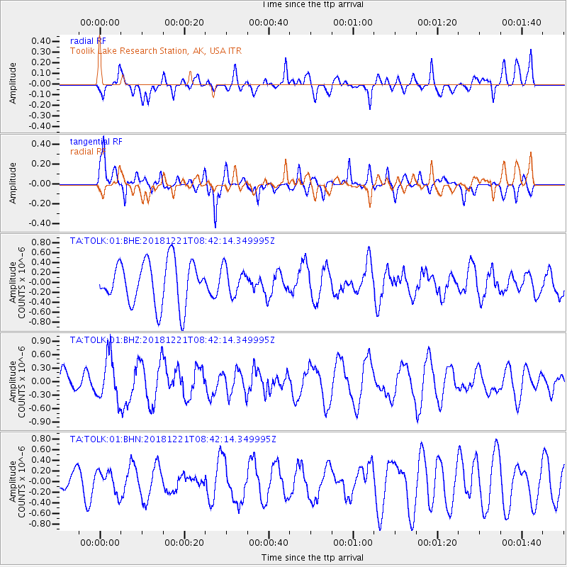
TOLK Toolik Lake Research Station, AK, USA - Earthquake Result Viewer
*The percent match for this event was below the threshold and hence no stack was calculated.
| Earthquake location: |
New Britain Region, P.N.G. |
| Earthquake latitude/longitude: |
-5.4/152.0 |
| Earthquake time(UTC): |
2018/12/21 (355) 08:30:15 GMT |
| Earthquake Depth: |
10 km |
| Earthquake Magnitude: |
5.7 Mww |
| Earthquake Catalog/Contributor: |
NEIC PDE/us |
|
| Network: |
TA USArray Transportable Network (new EarthScope stations) |
| Station: |
TOLK Toolik Lake Research Station, AK, USA |
| Lat/Lon: |
68.64 N/149.57 W |
| Elevation: |
760 m |
|
| Distance: |
84.0 deg |
| Az: |
18.291 deg |
| Baz: |
238.533 deg |
| Ray Param: |
$rayparam |
*The percent match for this event was below the threshold and hence was not used in the summary stack. |
|
| Radial Match: |
39.559032 % |
| Radial Bump: |
400 |
| Transverse Match: |
60.197464 % |
| Transverse Bump: |
400 |
| SOD ConfigId: |
3201911 |
| Insert Time: |
2019-01-04 08:38:57.233 +0000 |
| GWidth: |
2.5 |
| Max Bumps: |
400 |
| Tol: |
0.001 |
|
Signal To Noise
| Channel | StoN | STA | LTA |
| TA:TOLK:01:BHZ:20181221T08:42:14.349995Z | 2.0118785 | 4.930617E-7 | 2.4507528E-7 |
| TA:TOLK:01:BHN:20181221T08:42:14.349995Z | 1.408855 | 2.1515015E-7 | 1.5271277E-7 |
| TA:TOLK:01:BHE:20181221T08:42:14.349995Z | 0.6240705 | 2.7224291E-7 | 4.3623743E-7 |
| Arrivals |
| Ps | |
| PpPs | |
| PsPs/PpSs | |


