You are here: Home > Network List > GS - US Geological Survey Networks Stations List
> Station KAN13 Rinehart Farm > Earthquake Result Viewer
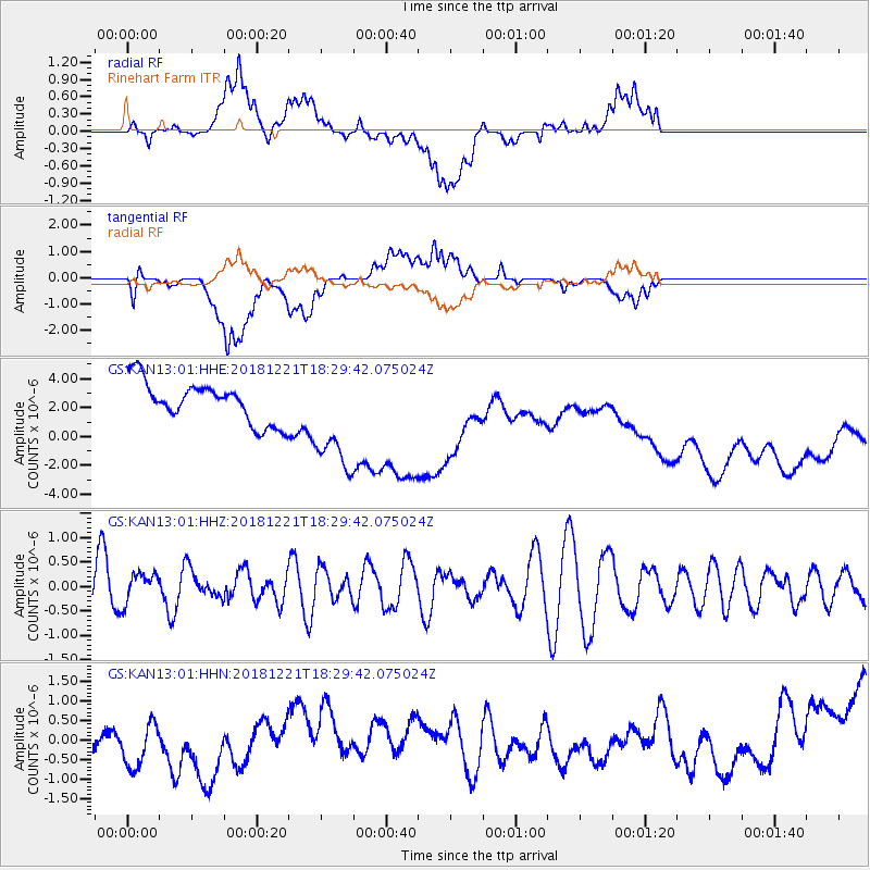
KAN13 Rinehart Farm - Earthquake Result Viewer
*The percent match for this event was below the threshold and hence no stack was calculated.
| Earthquake location: |
Komandorskiye Ostrova Region |
| Earthquake latitude/longitude: |
55.3/164.4 |
| Earthquake time(UTC): |
2018/12/21 (355) 18:19:36 GMT |
| Earthquake Depth: |
16 km |
| Earthquake Magnitude: |
5.6 Mww |
| Earthquake Catalog/Contributor: |
NEIC PDE/us |
|
| Network: |
GS US Geological Survey Networks |
| Station: |
KAN13 Rinehart Farm |
| Lat/Lon: |
37.01 N/97.48 W |
| Elevation: |
340 m |
|
| Distance: |
64.7 deg |
| Az: |
61.221 deg |
| Baz: |
321.199 deg |
| Ray Param: |
$rayparam |
*The percent match for this event was below the threshold and hence was not used in the summary stack. |
|
| Radial Match: |
21.635918 % |
| Radial Bump: |
400 |
| Transverse Match: |
20.456263 % |
| Transverse Bump: |
400 |
| SOD ConfigId: |
3201911 |
| Insert Time: |
2019-01-04 18:30:15.365 +0000 |
| GWidth: |
2.5 |
| Max Bumps: |
400 |
| Tol: |
0.001 |
|
Signal To Noise
| Channel | StoN | STA | LTA |
| GS:KAN13:01:HHZ:20181221T18:29:42.075024Z | 0.8165919 | 3.0781027E-7 | 3.7694502E-7 |
| GS:KAN13:01:HHN:20181221T18:29:42.075024Z | 1.5422369 | 8.7323025E-7 | 5.6621013E-7 |
| GS:KAN13:01:HHE:20181221T18:29:42.075024Z | 2.5745068 | 3.6479505E-6 | 1.4169514E-6 |
| Arrivals |
| Ps | |
| PpPs | |
| PsPs/PpSs | |


