You are here: Home > Network List > GS - US Geological Survey Networks Stations List
> Station OK051 E0350 and S34600 Roads, Ralston, OK > Earthquake Result Viewer
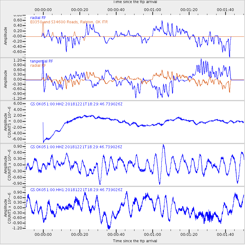
OK051 E0350 and S34600 Roads, Ralston, OK - Earthquake Result Viewer
*The percent match for this event was below the threshold and hence no stack was calculated.
| Earthquake location: |
Komandorskiye Ostrova Region |
| Earthquake latitude/longitude: |
55.3/164.4 |
| Earthquake time(UTC): |
2018/12/21 (355) 18:19:36 GMT |
| Earthquake Depth: |
16 km |
| Earthquake Magnitude: |
5.6 Mww |
| Earthquake Catalog/Contributor: |
NEIC PDE/us |
|
| Network: |
GS US Geological Survey Networks |
| Station: |
OK051 E0350 and S34600 Roads, Ralston, OK |
| Lat/Lon: |
36.51 N/96.84 W |
| Elevation: |
263 m |
|
| Distance: |
65.4 deg |
| Az: |
61.126 deg |
| Baz: |
321.541 deg |
| Ray Param: |
$rayparam |
*The percent match for this event was below the threshold and hence was not used in the summary stack. |
|
| Radial Match: |
24.421906 % |
| Radial Bump: |
400 |
| Transverse Match: |
38.49671 % |
| Transverse Bump: |
400 |
| SOD ConfigId: |
3201911 |
| Insert Time: |
2019-01-04 18:30:23.772 +0000 |
| GWidth: |
2.5 |
| Max Bumps: |
400 |
| Tol: |
0.001 |
|
Signal To Noise
| Channel | StoN | STA | LTA |
| GS:OK051:00:HHZ:20181221T18:29:46.739026Z | 0.63978016 | 1.8553824E-7 | 2.9000313E-7 |
| GS:OK051:00:HH1:20181221T18:29:46.739026Z | 0.8314887 | 4.1483167E-7 | 4.9890235E-7 |
| GS:OK051:00:HH2:20181221T18:29:46.739026Z | 0.9364193 | 2.6726318E-6 | 2.8540974E-6 |
| Arrivals |
| Ps | |
| PpPs | |
| PsPs/PpSs | |


