You are here: Home > Network List > WY - Yellowstone Wyoming Seismic Network Stations List
> Station YHH Holmes Hill, YNP, WY, USA > Earthquake Result Viewer
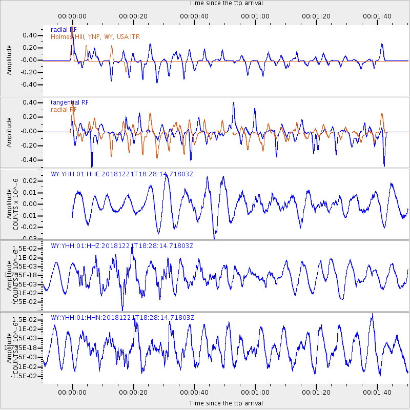
YHH Holmes Hill, YNP, WY, USA - Earthquake Result Viewer
*The percent match for this event was below the threshold and hence no stack was calculated.
| Earthquake location: |
Komandorskiye Ostrova Region |
| Earthquake latitude/longitude: |
55.3/164.4 |
| Earthquake time(UTC): |
2018/12/21 (355) 18:19:36 GMT |
| Earthquake Depth: |
16 km |
| Earthquake Magnitude: |
5.6 Mww |
| Earthquake Catalog/Contributor: |
NEIC PDE/us |
|
| Network: |
WY Yellowstone Wyoming Seismic Network |
| Station: |
YHH Holmes Hill, YNP, WY, USA |
| Lat/Lon: |
44.79 N/110.85 W |
| Elevation: |
2717 m |
|
| Distance: |
52.2 deg |
| Az: |
63.863 deg |
| Baz: |
313.824 deg |
| Ray Param: |
$rayparam |
*The percent match for this event was below the threshold and hence was not used in the summary stack. |
|
| Radial Match: |
55.801506 % |
| Radial Bump: |
357 |
| Transverse Match: |
64.591545 % |
| Transverse Bump: |
400 |
| SOD ConfigId: |
3201911 |
| Insert Time: |
2019-01-04 18:33:43.222 +0000 |
| GWidth: |
2.5 |
| Max Bumps: |
400 |
| Tol: |
0.001 |
|
Signal To Noise
| Channel | StoN | STA | LTA |
| WY:YHH:01:HHZ:20181221T18:28:14.71803Z | 0.50989515 | 4.589884E-9 | 9.0016234E-9 |
| WY:YHH:01:HHN:20181221T18:28:14.71803Z | 0.7227877 | 6.5222228E-9 | 9.023705E-9 |
| WY:YHH:01:HHE:20181221T18:28:14.71803Z | 2.5213628 | 1.6618106E-8 | 6.590922E-9 |
| Arrivals |
| Ps | |
| PpPs | |
| PsPs/PpSs | |


