You are here: Home > Network List > TA - USArray Transportable Network (new EarthScope stations) Stations List
> Station D26A Manning, ND, USA > Earthquake Result Viewer
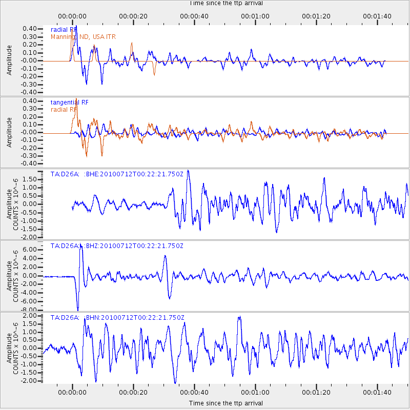
D26A Manning, ND, USA - Earthquake Result Viewer
*The percent match for this event was below the threshold and hence no stack was calculated.
| Earthquake location: |
Northern Chile |
| Earthquake latitude/longitude: |
-22.1/-68.2 |
| Earthquake time(UTC): |
2010/07/12 (193) 00:11:21 GMT |
| Earthquake Depth: |
115 km |
| Earthquake Magnitude: |
6.1 MB, 6.3 MW, 6.2 MW |
| Earthquake Catalog/Contributor: |
WHDF/NEIC |
|
| Network: |
TA USArray Transportable Network (new EarthScope stations) |
| Station: |
D26A Manning, ND, USA |
| Lat/Lon: |
47.03 N/102.44 W |
| Elevation: |
693 m |
|
| Distance: |
75.5 deg |
| Az: |
336.583 deg |
| Baz: |
147.41 deg |
| Ray Param: |
$rayparam |
*The percent match for this event was below the threshold and hence was not used in the summary stack. |
|
| Radial Match: |
93.03516 % |
| Radial Bump: |
400 |
| Transverse Match: |
77.86602 % |
| Transverse Bump: |
400 |
| SOD ConfigId: |
319893 |
| Insert Time: |
2011-01-05 02:28:20.139 +0000 |
| GWidth: |
2.5 |
| Max Bumps: |
400 |
| Tol: |
0.001 |
|
Signal To Noise
| Channel | StoN | STA | LTA |
| TA:D26A: :BHZ:20100712T00:22:21.750Z | 33.331802 | 3.9717415E-6 | 1.19157725E-7 |
| TA:D26A: :BHN:20100712T00:22:21.750Z | 4.745963 | 9.069277E-7 | 1.9109456E-7 |
| TA:D26A: :BHE:20100712T00:22:21.750Z | 2.2061563 | 5.013063E-7 | 2.2723064E-7 |
| Arrivals |
| Ps | |
| PpPs | |
| PsPs/PpSs | |


