You are here: Home > Network List > TA - USArray Transportable Network (new EarthScope stations) Stations List
> Station B29A Wagenman Farm, Cando, ND, USA > Earthquake Result Viewer
B29A Wagenman Farm, Cando, ND, USA - Earthquake Result Viewer

| Earthquake location: |
Northern Chile |
| Earthquake latitude/longitude: |
-22.1/-68.2 |
| Earthquake time(UTC): |
2010/07/12 (193) 00:11:21 GMT |
| Earthquake Depth: |
115 km |
| Earthquake Magnitude: |
6.1 MB, 6.3 MW, 6.2 MW |
| Earthquake Catalog/Contributor: |
WHDF/NEIC |
|
| Network: |
TA USArray Transportable Network (new EarthScope stations) |
| Station: |
B29A Wagenman Farm, Cando, ND, USA |
| Lat/Lon: |
48.46 N/99.35 W |
| Elevation: |
460 m |
|
| Distance: |
75.6 deg |
| Az: |
339.188 deg |
| Baz: |
150.336 deg |
| Ray Param: |
0.051271655 |
| Estimated Moho Depth: |
11.5 km |
| Estimated Crust Vp/Vs: |
1.61 |
| Assumed Crust Vp: |
6.53 km/s |
| Estimated Crust Vs: |
4.056 km/s |
| Estimated Crust Poisson's Ratio: |
0.19 |
|
| Radial Match: |
93.318924 % |
| Radial Bump: |
400 |
| Transverse Match: |
82.197334 % |
| Transverse Bump: |
400 |
| SOD ConfigId: |
319893 |
| Insert Time: |
2011-01-05 02:29:59.210 +0000 |
| GWidth: |
2.5 |
| Max Bumps: |
400 |
| Tol: |
0.001 |
|
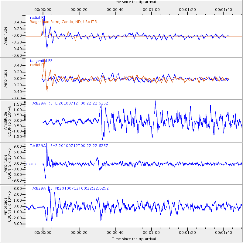
Signal To Noise
| Channel | StoN | STA | LTA |
| TA:B29A: :BHZ:20100712T00:22:22.625Z | 51.967033 | 3.6202357E-6 | 6.966408E-8 |
| TA:B29A: :BHN:20100712T00:22:22.625Z | 9.356223 | 1.6911237E-6 | 1.8074853E-7 |
| TA:B29A: :BHE:20100712T00:22:22.625Z | 6.391537 | 9.4637795E-7 | 1.4806734E-7 |
| Arrivals |
| Ps | 1.1 SECOND |
| PpPs | 4.4 SECOND |
| PsPs/PpSs | 5.5 SECOND |


