You are here: Home > Network List > TA - USArray Transportable Network (new EarthScope stations) Stations List
> Station 339A Huntington, TX, USA > Earthquake Result Viewer
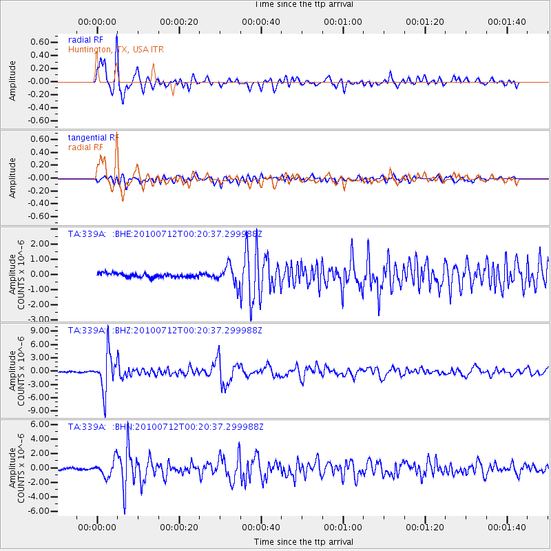
339A Huntington, TX, USA - Earthquake Result Viewer
*The percent match for this event was below the threshold and hence no stack was calculated.
| Earthquake location: |
Northern Chile |
| Earthquake latitude/longitude: |
-22.1/-68.2 |
| Earthquake time(UTC): |
2010/07/12 (193) 00:11:21 GMT |
| Earthquake Depth: |
115 km |
| Earthquake Magnitude: |
6.1 MB, 6.3 MW, 6.2 MW |
| Earthquake Catalog/Contributor: |
WHDF/NEIC |
|
| Network: |
TA USArray Transportable Network (new EarthScope stations) |
| Station: |
339A Huntington, TX, USA |
| Lat/Lon: |
31.33 N/94.56 W |
| Elevation: |
82 m |
|
| Distance: |
58.9 deg |
| Az: |
333.669 deg |
| Baz: |
151.278 deg |
| Ray Param: |
$rayparam |
*The percent match for this event was below the threshold and hence was not used in the summary stack. |
|
| Radial Match: |
94.551186 % |
| Radial Bump: |
400 |
| Transverse Match: |
81.07788 % |
| Transverse Bump: |
400 |
| SOD ConfigId: |
319893 |
| Insert Time: |
2011-01-05 02:38:20.089 +0000 |
| GWidth: |
2.5 |
| Max Bumps: |
400 |
| Tol: |
0.001 |
|
Signal To Noise
| Channel | StoN | STA | LTA |
| TA:339A: :BHZ:20100712T00:20:37.299988Z | 48.478535 | 4.304807E-6 | 8.879821E-8 |
| TA:339A: :BHN:20100712T00:20:37.299988Z | 8.497495 | 1.1737402E-6 | 1.3812779E-7 |
| TA:339A: :BHE:20100712T00:20:37.299988Z | 4.886071 | 6.292168E-7 | 1.2877766E-7 |
| Arrivals |
| Ps | |
| PpPs | |
| PsPs/PpSs | |


