You are here: Home > Network List > US - United States National Seismic Network Stations List
> Station HAWA Hanford, Washington, USA > Earthquake Result Viewer
HAWA Hanford, Washington, USA - Earthquake Result Viewer
*The percent match for this event was below the threshold and hence no stack was calculated.
| Earthquake location: |
Northern Chile |
| Earthquake latitude/longitude: |
-22.1/-68.2 |
| Earthquake time(UTC): |
2010/07/12 (193) 00:11:21 GMT |
| Earthquake Depth: |
115 km |
| Earthquake Magnitude: |
6.1 MB, 6.3 MW, 6.2 MW |
| Earthquake Catalog/Contributor: |
WHDF/NEIC |
|
| Network: |
US United States National Seismic Network |
| Station: |
HAWA Hanford, Washington, USA |
| Lat/Lon: |
46.39 N/119.53 W |
| Elevation: |
364 m |
|
| Distance: |
82.5 deg |
| Az: |
326.978 deg |
| Baz: |
133.117 deg |
| Ray Param: |
$rayparam |
*The percent match for this event was below the threshold and hence was not used in the summary stack. |
|
| Radial Match: |
95.43981 % |
| Radial Bump: |
238 |
| Transverse Match: |
95.26203 % |
| Transverse Bump: |
257 |
| SOD ConfigId: |
319893 |
| Insert Time: |
2011-01-05 02:46:19.600 +0000 |
| GWidth: |
2.5 |
| Max Bumps: |
400 |
| Tol: |
0.001 |
|
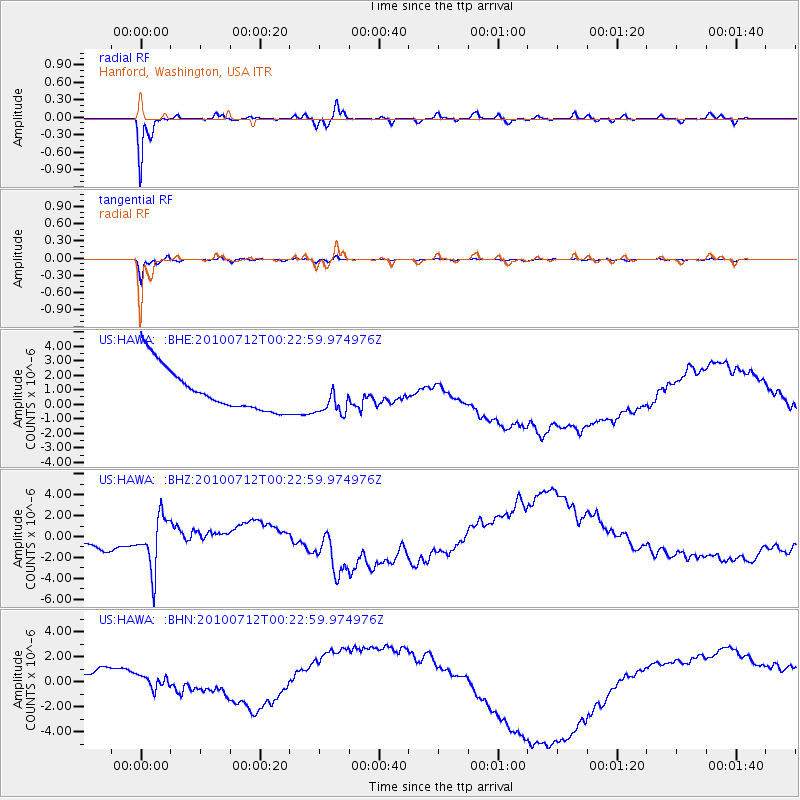
Signal To Noise
| Channel | StoN | STA | LTA |
| US:HAWA: :BHZ:20100712T00:22:59.974976Z | 1.3352494 | 2.9598389E-6 | 2.2166937E-6 |
| US:HAWA: :BHN:20100712T00:22:59.974976Z | 0.6999184 | 1.8609163E-6 | 2.658762E-6 |
| US:HAWA: :BHE:20100712T00:22:59.974976Z | 0.8135802 | 1.2202931E-6 | 1.4999051E-6 |
| Arrivals |
| Ps | |
| PpPs | |
| PsPs/PpSs | |


