You are here: Home > Network List > IW - Intermountain West Stations List
> Station MOOW Moose Ponds, Wyoming, USA > Earthquake Result Viewer
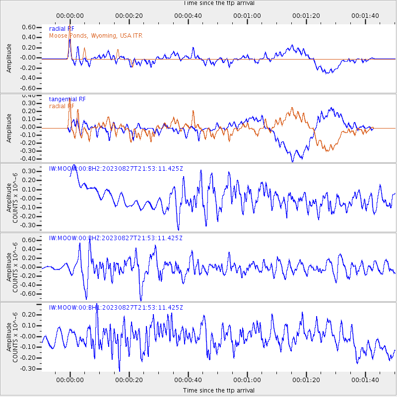
MOOW Moose Ponds, Wyoming, USA - Earthquake Result Viewer
*The percent match for this event was below the threshold and hence no stack was calculated.
| Earthquake location: |
Colombia |
| Earthquake latitude/longitude: |
5.3/-76.7 |
| Earthquake time(UTC): |
2023/08/27 (239) 21:44:59 GMT |
| Earthquake Depth: |
15 km |
| Earthquake Magnitude: |
5.7 Mww |
| Earthquake Catalog/Contributor: |
NEIC PDE/us |
|
| Network: |
IW Intermountain West |
| Station: |
MOOW Moose Ponds, Wyoming, USA |
| Lat/Lon: |
43.75 N/110.74 W |
| Elevation: |
2128 m |
|
| Distance: |
48.6 deg |
| Az: |
327.239 deg |
| Baz: |
131.968 deg |
| Ray Param: |
$rayparam |
*The percent match for this event was below the threshold and hence was not used in the summary stack. |
|
| Radial Match: |
46.285877 % |
| Radial Bump: |
400 |
| Transverse Match: |
46.45958 % |
| Transverse Bump: |
400 |
| SOD ConfigId: |
31937991 |
| Insert Time: |
2023-09-10 22:02:29.926 +0000 |
| GWidth: |
2.5 |
| Max Bumps: |
400 |
| Tol: |
0.001 |
|
Signal To Noise
| Channel | StoN | STA | LTA |
| IW:MOOW:00:BHZ:20230827T21:53:11.425Z | 3.837453 | 2.1730287E-7 | 5.6626853E-8 |
| IW:MOOW:00:BH1:20230827T21:53:11.425Z | 0.74210835 | 5.8515695E-8 | 7.885061E-8 |
| IW:MOOW:00:BH2:20230827T21:53:11.425Z | 1.1149206 | 1.3930912E-7 | 1.249498E-7 |
| Arrivals |
| Ps | |
| PpPs | |
| PsPs/PpSs | |


