You are here: Home > Network List > UW - Pacific Northwest Regional Seismic Network Stations List
> Station MRBL Marblemount, WA, USA > Earthquake Result Viewer
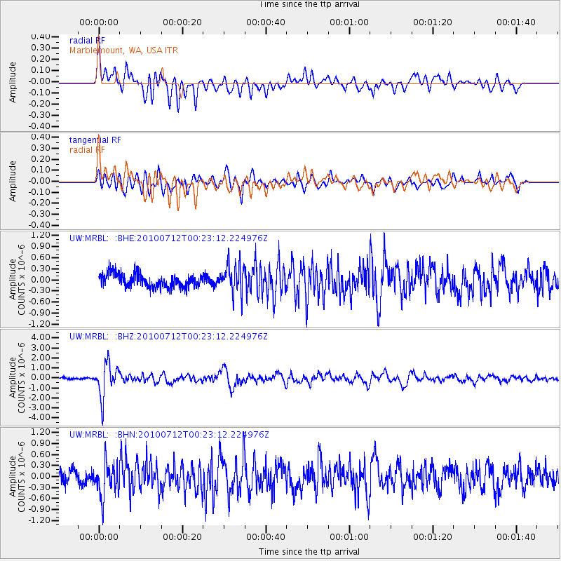
MRBL Marblemount, WA, USA - Earthquake Result Viewer
*The percent match for this event was below the threshold and hence no stack was calculated.
| Earthquake location: |
Northern Chile |
| Earthquake latitude/longitude: |
-22.1/-68.2 |
| Earthquake time(UTC): |
2010/07/12 (193) 00:11:21 GMT |
| Earthquake Depth: |
115 km |
| Earthquake Magnitude: |
6.1 MB, 6.3 MW, 6.2 MW |
| Earthquake Catalog/Contributor: |
WHDF/NEIC |
|
| Network: |
UW Pacific Northwest Regional Seismic Network |
| Station: |
MRBL Marblemount, WA, USA |
| Lat/Lon: |
48.52 N/121.48 W |
| Elevation: |
75 m |
|
| Distance: |
84.9 deg |
| Az: |
327.658 deg |
| Baz: |
131.758 deg |
| Ray Param: |
$rayparam |
*The percent match for this event was below the threshold and hence was not used in the summary stack. |
|
| Radial Match: |
78.0601 % |
| Radial Bump: |
400 |
| Transverse Match: |
84.77378 % |
| Transverse Bump: |
400 |
| SOD ConfigId: |
319893 |
| Insert Time: |
2011-01-05 02:49:38.757 +0000 |
| GWidth: |
2.5 |
| Max Bumps: |
400 |
| Tol: |
0.001 |
|
Signal To Noise
| Channel | StoN | STA | LTA |
| UW:MRBL: :BHZ:20100712T00:23:12.224976Z | 15.912642 | 1.6910044E-6 | 1.0626799E-7 |
| UW:MRBL: :BHN:20100712T00:23:12.224976Z | 2.6080985 | 4.6324374E-7 | 1.7761742E-7 |
| UW:MRBL: :BHE:20100712T00:23:12.224976Z | 2.2286236 | 3.904202E-7 | 1.7518445E-7 |
| Arrivals |
| Ps | |
| PpPs | |
| PsPs/PpSs | |


