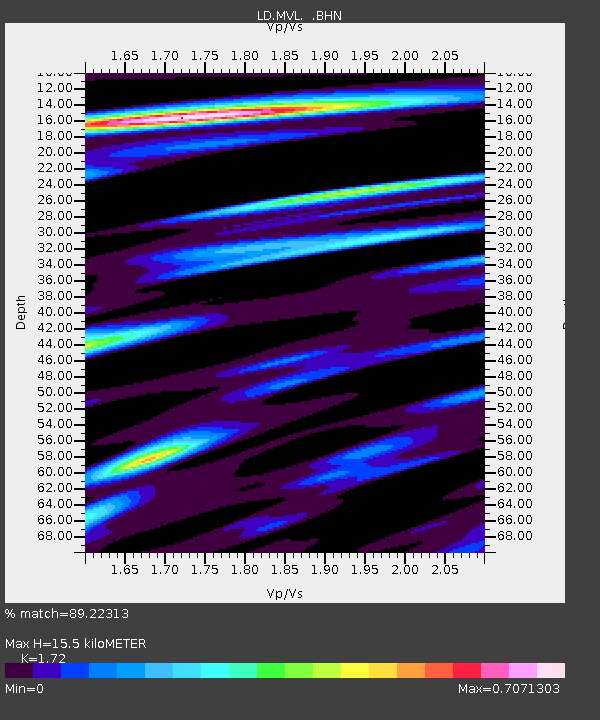
MVL Millersville University, PA - Earthquake Result Viewer
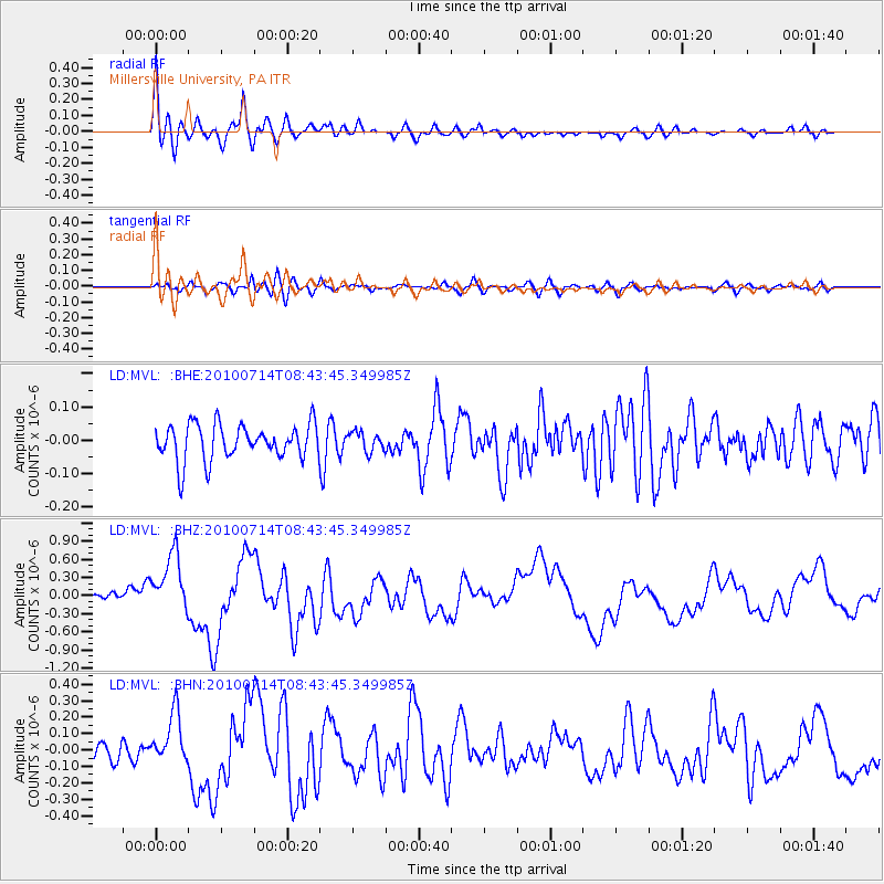
Earthquake location: Near Coast Of Central Chile
Earthquake latitude/longitude: -38.1/-73.3
Earthquake time(UTC): 2010/07/14 (195) 08:32:21 GMT
Earthquake Depth: 22 km
Earthquake Magnitude: 5.9 MB, 6.5 MS, 6.6 MW, 6.5 MW
Earthquake Catalog/Contributor: WHDF/NEIC
Network: LD Lamont-Doherty Cooperative Seismographic Network
Station: MVL Millersville University, PA
Lat/Lon: 40.00 N/76.35 W
Elevation: 91 m
Distance: 77.7 deg
Az: 357.61 deg
Baz: 177.544 deg
Ray Param: 0.050093886
Estimated Moho Depth: 15.5 km
Estimated Crust Vp/Vs: 1.72
Assumed Crust Vp: 6.419 km/s
Estimated Crust Vs: 3.732 km/s
Estimated Crust Poisson's Ratio: 0.24
Radial Match: 89.22313 %
Radial Bump: 400
Transverse Match: 73.13752 %
Transverse Bump: 400
SOD ConfigId: 319893
Insert Time: 2011-01-05 02:59:12.395 +0000
GWidth: 2.5
Max Bumps: 400
Tol: 0.001

Signal To Noise

ChannelStoNSTALTA
LD:MVL: :BHZ:20100714T08:43:45.349985Z5.68186335.225428E-79.19668E-8
LD:MVL: :BHN:20100714T08:43:45.349985Z4.3617951.5647484E-73.5873956E-8
LD:MVL: :BHE:20100714T08:43:45.349985Z0.538717272.8650083E-85.3182042E-8
Arrivals
Ps1.8 SECOND
PpPs6.4 SECOND
PsPs/PpSs8.2 SECOND