You are here: Home > Network List > US - United States National Seismic Network Stations List
> Station DGMT Dagmar, Montana, USA > Earthquake Result Viewer
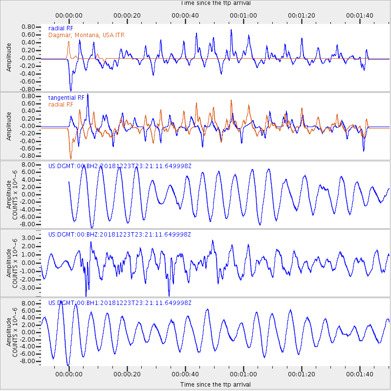
DGMT Dagmar, Montana, USA - Earthquake Result Viewer
*The percent match for this event was below the threshold and hence no stack was calculated.
| Earthquake location: |
Tonga Islands |
| Earthquake latitude/longitude: |
-20.4/-175.1 |
| Earthquake time(UTC): |
2018/12/23 (357) 23:08:40 GMT |
| Earthquake Depth: |
100 km |
| Earthquake Magnitude: |
6.4 mww |
| Earthquake Catalog/Contributor: |
NEIC PDE/us |
|
| Network: |
US United States National Seismic Network |
| Station: |
DGMT Dagmar, Montana, USA |
| Lat/Lon: |
48.47 N/104.20 W |
| Elevation: |
0.0 m |
|
| Distance: |
93.1 deg |
| Az: |
39.034 deg |
| Baz: |
242.601 deg |
| Ray Param: |
$rayparam |
*The percent match for this event was below the threshold and hence was not used in the summary stack. |
|
| Radial Match: |
58.851185 % |
| Radial Bump: |
397 |
| Transverse Match: |
40.064903 % |
| Transverse Bump: |
242 |
| SOD ConfigId: |
3201911 |
| Insert Time: |
2019-01-06 23:18:55.578 +0000 |
| GWidth: |
2.5 |
| Max Bumps: |
400 |
| Tol: |
0.001 |
|
Signal To Noise
| Channel | StoN | STA | LTA |
| US:DGMT:00:BHZ:20181223T23:21:11.649998Z | 0.8485589 | 7.6375267E-7 | 9.000585E-7 |
| US:DGMT:00:BH1:20181223T23:21:11.649998Z | 2.0030653 | 6.0664556E-6 | 3.028586E-6 |
| US:DGMT:00:BH2:20181223T23:21:11.649998Z | 0.37364855 | 1.9892238E-6 | 5.323783E-6 |
| Arrivals |
| Ps | |
| PpPs | |
| PsPs/PpSs | |


