
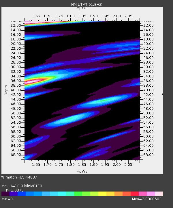
UTMT Martin, TN - Earthquake Result Viewer
| ||||||||||||||||||
| ||||||||||||||||||
| ||||||||||||||||||
|
Signal To Noise
| Channel | StoN | STA | LTA |
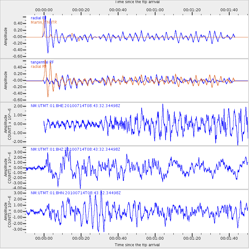
| NM:UTMT:01:BHZ:20100714T08:43:32.34498Z | 7.81682 | 1.0677022E-6 | 1.3659034E-7 |
| NM:UTMT:01:BHN:20100714T08:43:32.34498Z | 1.575295 | 6.085217E-7 | 3.8629062E-7 |
| NM:UTMT:01:BHE:20100714T08:43:32.34498Z | 1.7556928 | 5.098271E-7 | 2.9038515E-7 |
| Arrivals | |
| Ps | 1.1 SECOND |
| PpPs | 4.0 SECOND |
| PsPs/PpSs | 5.1 SECOND |

