You are here: Home > Network List > GS - US Geological Survey Networks Stations List
> Station KAN13 Rinehart Farm > Earthquake Result Viewer
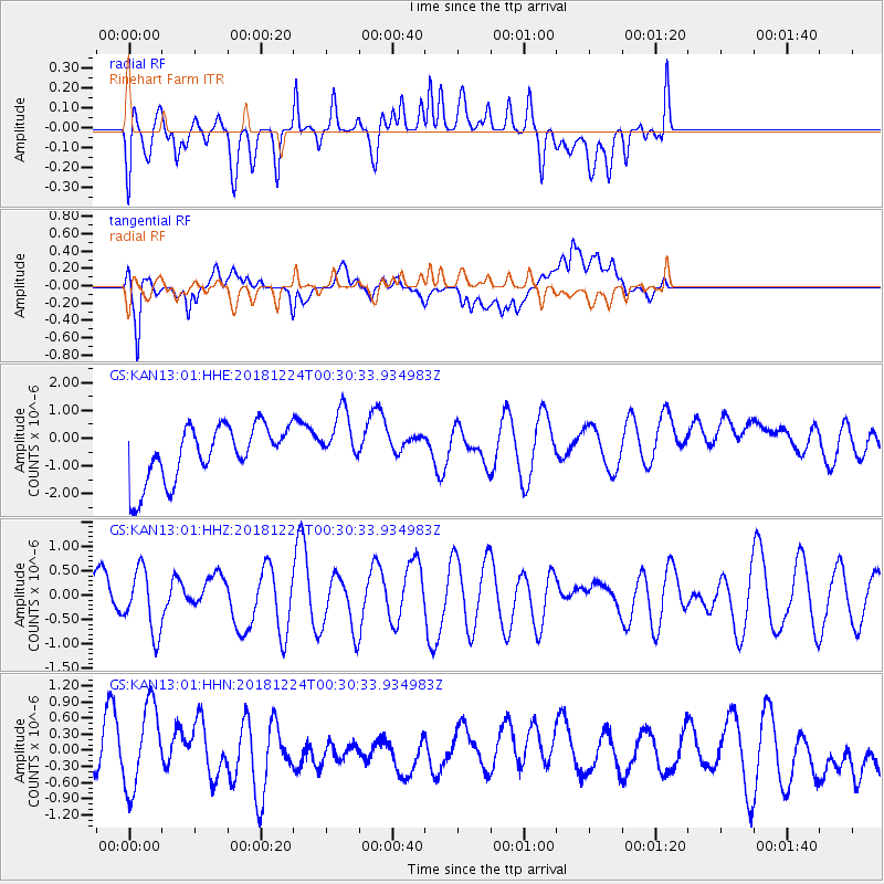
KAN13 Rinehart Farm - Earthquake Result Viewer
*The percent match for this event was below the threshold and hence no stack was calculated.
| Earthquake location: |
Off East Coast Of Honshu, Japan |
| Earthquake latitude/longitude: |
34.1/141.8 |
| Earthquake time(UTC): |
2018/12/24 (358) 00:18:05 GMT |
| Earthquake Depth: |
18 km |
| Earthquake Magnitude: |
5.6 Mww |
| Earthquake Catalog/Contributor: |
NEIC PDE/us |
|
| Network: |
GS US Geological Survey Networks |
| Station: |
KAN13 Rinehart Farm |
| Lat/Lon: |
37.01 N/97.48 W |
| Elevation: |
340 m |
|
| Distance: |
90.3 deg |
| Az: |
43.506 deg |
| Baz: |
314.437 deg |
| Ray Param: |
$rayparam |
*The percent match for this event was below the threshold and hence was not used in the summary stack. |
|
| Radial Match: |
33.681793 % |
| Radial Bump: |
400 |
| Transverse Match: |
55.982277 % |
| Transverse Bump: |
400 |
| SOD ConfigId: |
3201911 |
| Insert Time: |
2019-01-07 00:20:55.044 +0000 |
| GWidth: |
2.5 |
| Max Bumps: |
400 |
| Tol: |
0.001 |
|
Signal To Noise
| Channel | StoN | STA | LTA |
| GS:KAN13:01:HHZ:20181224T00:30:33.934983Z | 1.488742 | 6.3624157E-7 | 4.2736858E-7 |
| GS:KAN13:01:HHN:20181224T00:30:33.934983Z | 1.3784045 | 8.4832476E-7 | 6.154396E-7 |
| GS:KAN13:01:HHE:20181224T00:30:33.934983Z | 1.0469842 | 1.0380074E-6 | 9.914261E-7 |
| Arrivals |
| Ps | |
| PpPs | |
| PsPs/PpSs | |


