You are here: Home > Network List > TX - Texas Seismological Network Stations List
> Station WTFS Witchita Falls > Earthquake Result Viewer
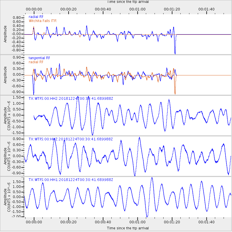
WTFS Witchita Falls - Earthquake Result Viewer
*The percent match for this event was below the threshold and hence no stack was calculated.
| Earthquake location: |
Off East Coast Of Honshu, Japan |
| Earthquake latitude/longitude: |
34.1/141.8 |
| Earthquake time(UTC): |
2018/12/24 (358) 00:18:05 GMT |
| Earthquake Depth: |
18 km |
| Earthquake Magnitude: |
5.6 Mww |
| Earthquake Catalog/Contributor: |
NEIC PDE/us |
|
| Network: |
TX Texas Seismological Network |
| Station: |
WTFS Witchita Falls |
| Lat/Lon: |
33.77 N/98.46 W |
| Elevation: |
277 m |
|
| Distance: |
92.0 deg |
| Az: |
46.393 deg |
| Baz: |
313.812 deg |
| Ray Param: |
$rayparam |
*The percent match for this event was below the threshold and hence was not used in the summary stack. |
|
| Radial Match: |
57.66239 % |
| Radial Bump: |
327 |
| Transverse Match: |
53.825756 % |
| Transverse Bump: |
232 |
| SOD ConfigId: |
3201911 |
| Insert Time: |
2019-01-07 00:23:18.211 +0000 |
| GWidth: |
2.5 |
| Max Bumps: |
400 |
| Tol: |
0.001 |
|
Signal To Noise
| Channel | StoN | STA | LTA |
| TX:WTFS:00:HHZ:20181224T00:30:41.689988Z | 0.25863126 | 1.1458299E-7 | 4.430361E-7 |
| TX:WTFS:00:HH1:20181224T00:30:41.689988Z | 0.97428393 | 7.933722E-7 | 8.143131E-7 |
| TX:WTFS:00:HH2:20181224T00:30:41.689988Z | 2.014225 | 1.1051735E-6 | 5.486842E-7 |
| Arrivals |
| Ps | |
| PpPs | |
| PsPs/PpSs | |


