You are here: Home > Network List > TA - USArray Transportable Network (new EarthScope stations) Stations List
> Station I23A Meade Ranch, Gillette, WY, USA > Earthquake Result Viewer
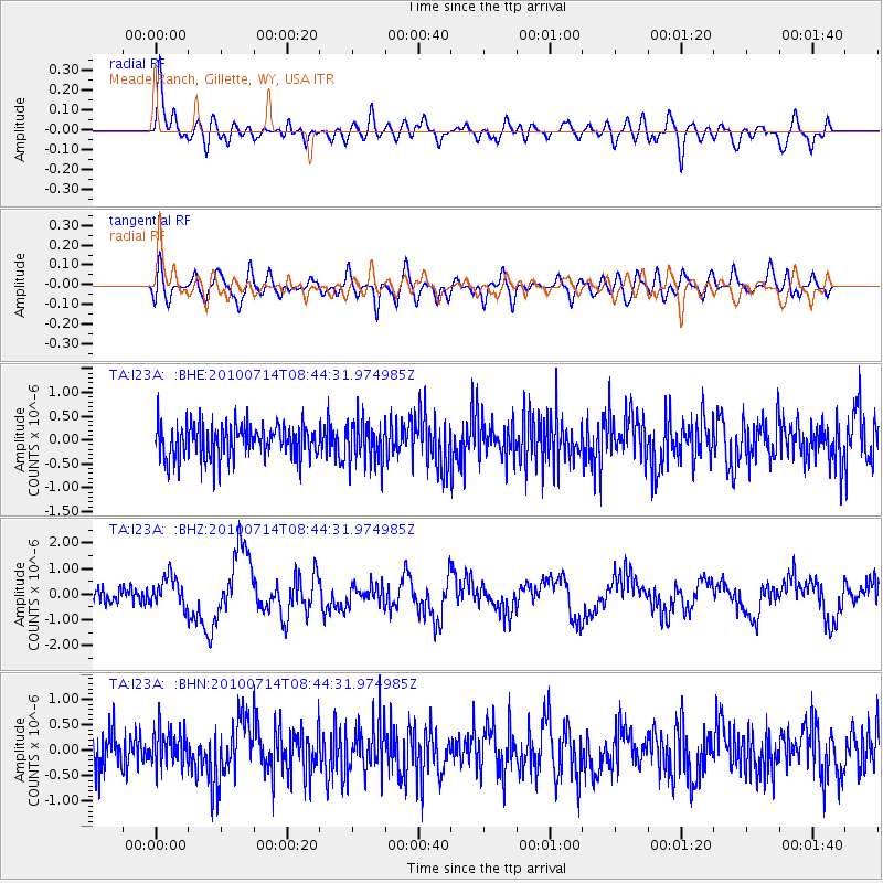
I23A Meade Ranch, Gillette, WY, USA - Earthquake Result Viewer
*The percent match for this event was below the threshold and hence no stack was calculated.
| Earthquake location: |
Near Coast Of Central Chile |
| Earthquake latitude/longitude: |
-38.1/-73.3 |
| Earthquake time(UTC): |
2010/07/14 (195) 08:32:21 GMT |
| Earthquake Depth: |
22 km |
| Earthquake Magnitude: |
5.9 MB, 6.5 MS, 6.6 MW, 6.5 MW |
| Earthquake Catalog/Contributor: |
WHDF/NEIC |
|
| Network: |
TA USArray Transportable Network (new EarthScope stations) |
| Station: |
I23A Meade Ranch, Gillette, WY, USA |
| Lat/Lon: |
43.96 N/105.46 W |
| Elevation: |
1462 m |
|
| Distance: |
86.7 deg |
| Az: |
337.359 deg |
| Baz: |
155.118 deg |
| Ray Param: |
$rayparam |
*The percent match for this event was below the threshold and hence was not used in the summary stack. |
|
| Radial Match: |
75.36195 % |
| Radial Bump: |
400 |
| Transverse Match: |
73.84271 % |
| Transverse Bump: |
400 |
| SOD ConfigId: |
319893 |
| Insert Time: |
2011-01-05 03:06:14.346 +0000 |
| GWidth: |
2.5 |
| Max Bumps: |
400 |
| Tol: |
0.001 |
|
Signal To Noise
| Channel | StoN | STA | LTA |
| TA:I23A: :BHZ:20100714T08:44:31.974985Z | 2.3067222 | 5.9098574E-7 | 2.5620153E-7 |
| TA:I23A: :BHN:20100714T08:44:31.974985Z | 1.1227155 | 3.6918203E-7 | 3.2882954E-7 |
| TA:I23A: :BHE:20100714T08:44:31.974985Z | 1.2344792 | 4.3987097E-7 | 3.5632112E-7 |
| Arrivals |
| Ps | |
| PpPs | |
| PsPs/PpSs | |


