You are here: Home > Network List > TA - USArray Transportable Network (new EarthScope stations) Stations List
> Station T29A Hugoton, KS, USA > Earthquake Result Viewer
T29A Hugoton, KS, USA - Earthquake Result Viewer

| Earthquake location: |
Near Coast Of Central Chile |
| Earthquake latitude/longitude: |
-38.1/-73.3 |
| Earthquake time(UTC): |
2010/07/14 (195) 08:32:21 GMT |
| Earthquake Depth: |
22 km |
| Earthquake Magnitude: |
5.9 MB, 6.5 MS, 6.6 MW, 6.5 MW |
| Earthquake Catalog/Contributor: |
WHDF/NEIC |
|
| Network: |
TA USArray Transportable Network (new EarthScope stations) |
| Station: |
T29A Hugoton, KS, USA |
| Lat/Lon: |
37.16 N/101.29 W |
| Elevation: |
936 m |
|
| Distance: |
79.2 deg |
| Az: |
337.564 deg |
| Baz: |
157.849 deg |
| Ray Param: |
0.049109578 |
| Estimated Moho Depth: |
46.75 km |
| Estimated Crust Vp/Vs: |
1.60 |
| Assumed Crust Vp: |
6.483 km/s |
| Estimated Crust Vs: |
4.045 km/s |
| Estimated Crust Poisson's Ratio: |
0.18 |
|
| Radial Match: |
90.72256 % |
| Radial Bump: |
400 |
| Transverse Match: |
79.08884 % |
| Transverse Bump: |
400 |
| SOD ConfigId: |
319893 |
| Insert Time: |
2011-01-05 03:13:46.991 +0000 |
| GWidth: |
2.5 |
| Max Bumps: |
400 |
| Tol: |
0.001 |
|
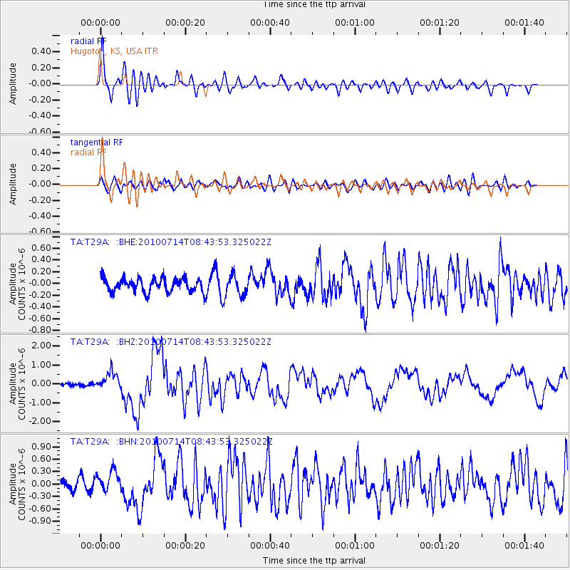
Signal To Noise
| Channel | StoN | STA | LTA |
| TA:T29A: :BHZ:20100714T08:43:53.325022Z | 5.4878526 | 4.7522235E-7 | 8.659532E-8 |
| TA:T29A: :BHN:20100714T08:43:53.325022Z | 1.9113474 | 2.5838847E-7 | 1.3518655E-7 |
| TA:T29A: :BHE:20100714T08:43:53.325022Z | 1.5440489 | 1.8083449E-7 | 1.17117075E-7 |
| Arrivals |
| Ps | 4.5 SECOND |
| PpPs | 18 SECOND |
| PsPs/PpSs | 23 SECOND |


